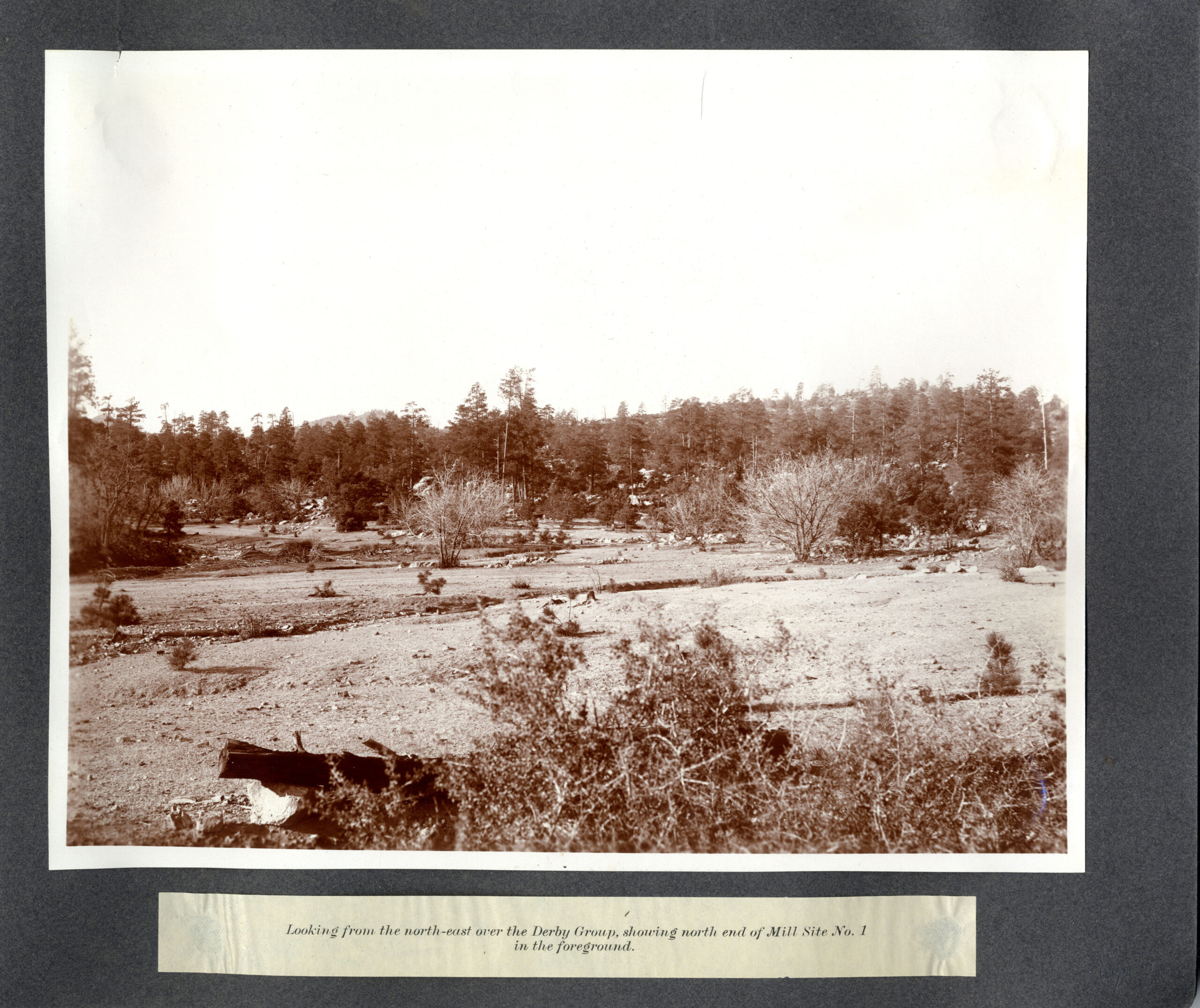
The original Yavapai County Assessor’s ‘maps‘ relating to the various PLATS of record for ‘Highland Pines‘ are conflicting to say the least. Below is the Assessor’s map of record for Highland Pines PLAT J, indicating some subdivided lots as well as metes and bounds parcels, according to the PLAT, within a lode mining claim which is referred to as the ‘PURITAN‘, per Mineral Survey 2424 -MS2424.
PLAT J states on it’s face that this is lying in the Thumb Butte District. There is a section corner indicated that is effectively tying the claims location on the ground, the surface of the earth, to a place somewhere. This PLAT J of Highland Pines, below, is from the 1960’s. Although very faint and hard to read, there is additional text on the document that includes reference to the Happy Strike, and Pen Alto No. 1 mining claims.
County Disclaimer
Additionally it can be seen clearly that this ‘map’ is understood to be per 2424 (Survey.) specifically. There is a clear relation to section 28, 27, 33 & 34 in Township 14N Range 3W. There is a special notation that reads NOTE: ‘POSITION OF MINE IN RELATION TO SECTION CORNER WAS FOUND TO DIFFER FROM PLAT OF M.S. THIS DIFFERENCE ALSO APPEARS ON SUBDIVISIONS PLAT “D” 8-88. ‘


The corner to section 28. 27, 33 and 34 in T14N Range 3W, per the Yavapai County Assessor’s map records, show a clear variation between the relation of the Puritan lode claim on the ground, as show on the above connecting map that shows PLATS A through F, and the relation to section corner on the ground on the individual PLATS of record for the subdivisions of Highland Pines, which comprise the connecting map above. In a perfect world this would be an oversight, but it is not that simple, as mineral survey 2424 itself, that the claims are being acknowledged of in these Assessor maps, etc., places the relation of the Puritan to the section corner more closely with that of the above connecting sheet.
The Result
It can’t be both ways, and neither are correct. It would be a further oversight to prematurely conclude that the conflict as illustrated is chalked up to the variation between original Mineral Survey 2424 v. the 1930’s resurvey (KINSEY), as far as the townships section lines relation to the PURITAN mine are concerned.
The overall picture here on the county plats, is one attempting to resemble MS2424. The shaded areas as shown on the connecting PLAT indicate the Highland Pines subdivisions, in contrast to the non-subdivided -non platted- metes and bounds areas, many of which included odd descriptions. There are parcels in the non subdivided areas outside of Highland Pines, but depicted to be within the various mining claims or lode claim spaces, per mineral survey of record MS2424.
The original ‘survey‘ from the General Land Office, MS2424, could have only been tied to the section corner location existing at that time, in 1907. Per the record, this could only be the unfinished 1871 Township PLAT and FIELD NOTES of S.W. Foreman, approved by John Wasson, an official record still to this day. The officially ordered complete township resurvey by Kinsey in the 1930’s, changed the relation of the illustrated MS2424 claimed positions, which is visually apparent on the Kinsey dependent resurvey plat, official to present day.
It does not appear by the field notes that Kinsey reconfirmed the ‘patented’ lands of MS2424 specifically in his field notes of record, in fact he could not have. Likely the ‘claims’ were presumed to be rightfully patented, and on the ground where one may have indicated they were in that day. The ‘main workings’ was out of the gully, the only gully that occupies the location of several names and claimants over the years. The same place everyone tells their stories from. The instructions were for a dependent resurvey, completing the overall township for the new official record. Although the conflicts were present historically, and continue to this day, most nothing has changed this general perception of the locus, for nearly 100 years.
One Comment
Comments are closed.