Most Recent
Curious Case of ‘The Derby’
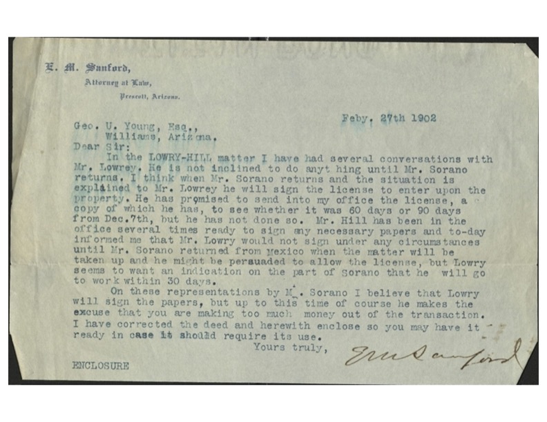
Put into ‘Evidence’ What lease is being referred to here in this letter from E.M. Sanford to George...
Yavapai County Treasurer’s Deed
No Redemption In 1947, A Treasurer’s Deed to the Highland Pines ‘premises’, Mineral Survey 2424 was issued and...
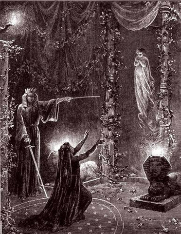
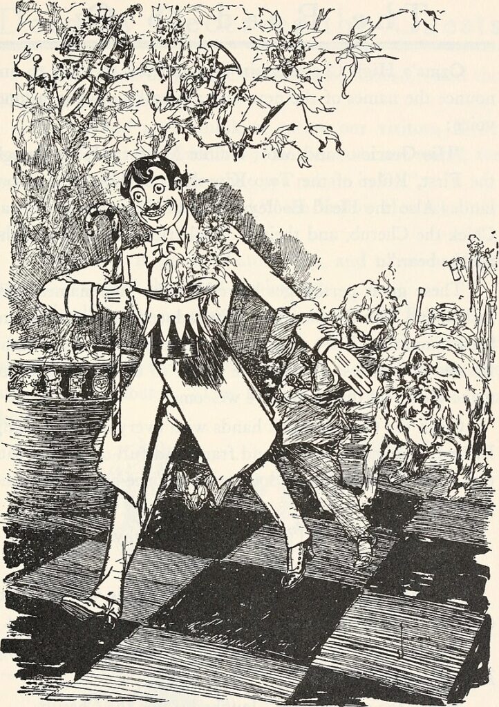
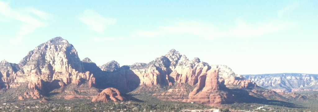
Follow the Yellow Brick Road
Stonewall Loeb George U. Young was an Arizona politician and a strategic planner who aligned his goals with...
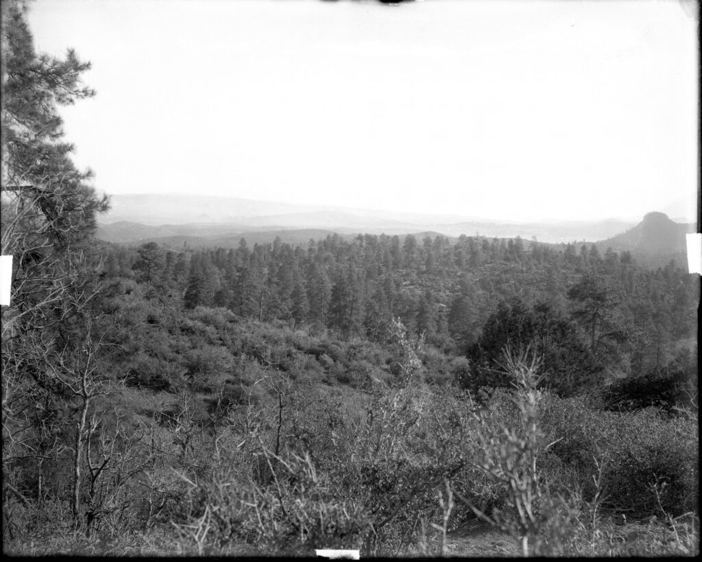
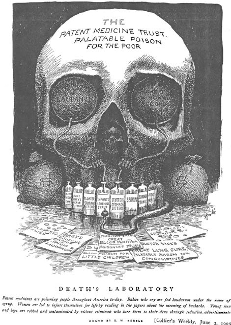
A land patent to Air.
First Impressions The U.S. land patent 818945, is in essence a quitclaim deed to nothing~that exists nowhere. Amongst...
U.S. Patent Deed to Highland Pines
The Puritan #3 and the Protection No. 2 Lode Claims The original application for U.S. mineral land patent...
Renting the Lowry Claims
The Golden Rule The Derby, the Madizelle property and the Lowry claims are all one and the same....
The Rule of 3: No. 1
Puritan, Peno Alto, Derby Creating is fun, creating in three’s is even more fun! The rule of three...

What’s Done in the Dark
How the Derby became the Madizelle Derby Mining Company, a corporation, by George U. Young its president, (E.M....
Entitlement to a Mineral Patent Under the Mining Law of 1872: Mineral Survey 2424
“U.S. Department of the Interior Memorandum M-36990, November 12 1997, Entitlement to a Mineral Patent. Introduction and Overview...
25 Mining Claims Bought & Paid: July 1, 1920, Madizelle Mining Company, United States Land Office
Attorney in Fact Department of the Interior Mineral Entry No. 045620, United States Land Office Phoenix Arizona, Application...
Madizelle Mining Company, claimant 419.692 Acres of Land: $2,100.00
IN RE Mineral Application Proof of Sums Paid ‘To the Receiver of the Local Office for Land’, $2,100.00...
OHIO Lode Claim @ Lowery-Hill Mine: Norman Hale & S.P. Hill, 1901
LODE-VEIN LOCATION Norman Hale and ‘S.P.’ Hill Notice of Mining Location dated January 21st, 1901 for the OHIO...
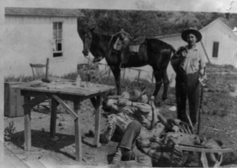
The Cook’s are Booked
Pre-Mineral Survey 2424 Final entries that would one day become the foundation for J.J. Fisher and Frank S....
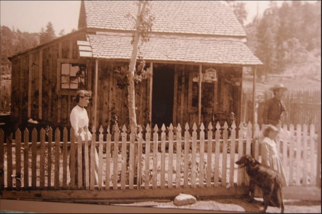
Land Conscience
Thievery Corporation ‘There is one part of the surveying business that Benson had down pat, and he has...
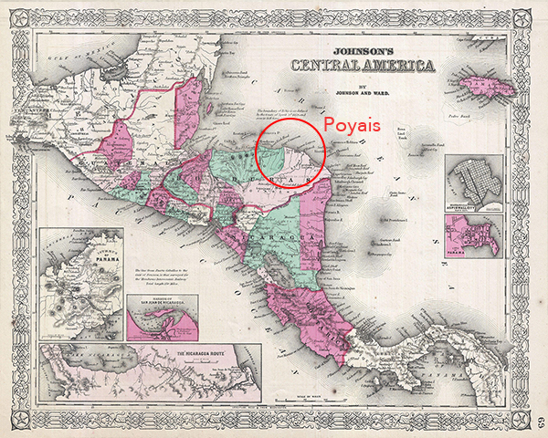
Imperial Entanglements
However rich Arizona mines have been, there is a suspicion that, before the days of copper, their net...
‘Brevity is the Soul of Wit’
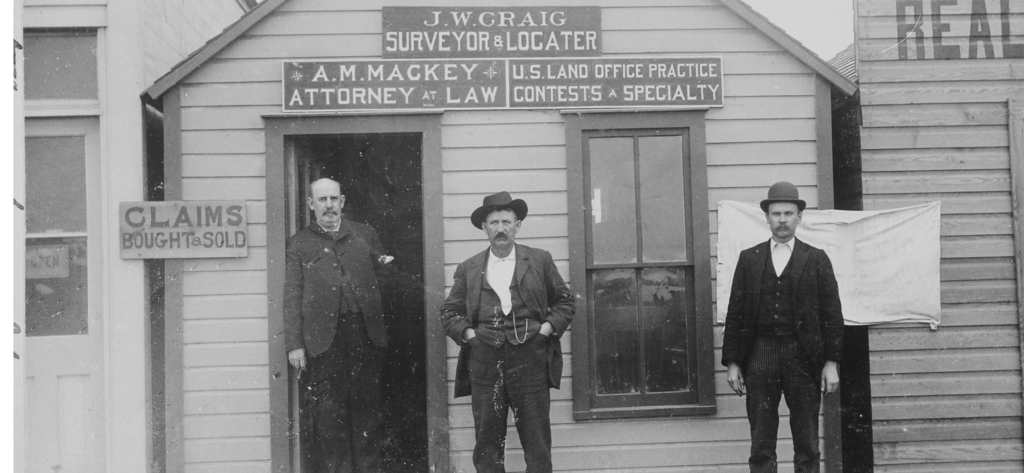
Retracement Surveyor Beware, Fraudulent surveys may be anywhere The recent article in the July/August issue of American Surveyor...
Royal A. Johnson U.S. Surveyor General Arizona Territory 1892 Instructions for Deputy Mineral Surveyors
“Before undertaking any official business, you are expected to make yourselves throughly familiar with the mining laws, and...
SKULDUGGERY ‘The Derby Mining Claims’: Progress Report Dec. 14, 1906
A fictitious ‘progress report’ on The Derby Mining Claims Thumb Butte District Yavaai County, Arizona, U.S.A. by Booth,...
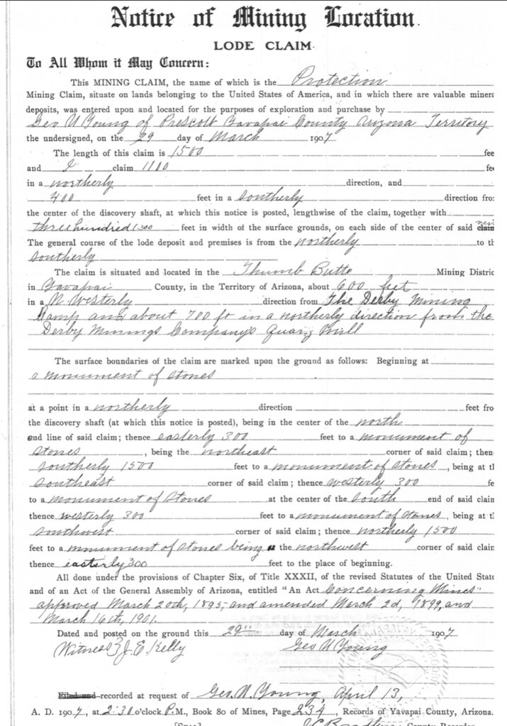
Protection Lode Claim
This is the Notice of mining location for the lode claim ‘Protection’. It does not say Protection #1,...
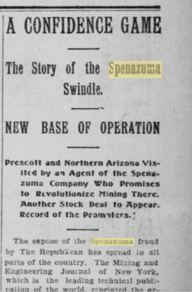
Madizelle x the All
A confidence game: The Story of the Madizelle swindle. Base of operation, The (former) Derby Mining Company, Prescott...
Protection #3 x Humbert x Protection #2
The most easterly 50’ of the depicted Protection #3 would actually be the Humbert lode, senior in right....
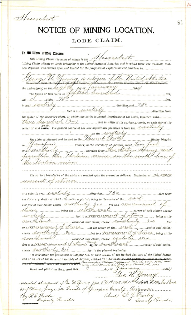
Humbert x Italian
There is a location notice recorded for the Humbert lode claim dated Jan 8, 1904, located by George...
Peno Alto No. 2 x Penos Alto No. 1
Similarly, the Peno Alto No. 2 lode was located before the 1906 Penos Alto No. 1 clim, in...
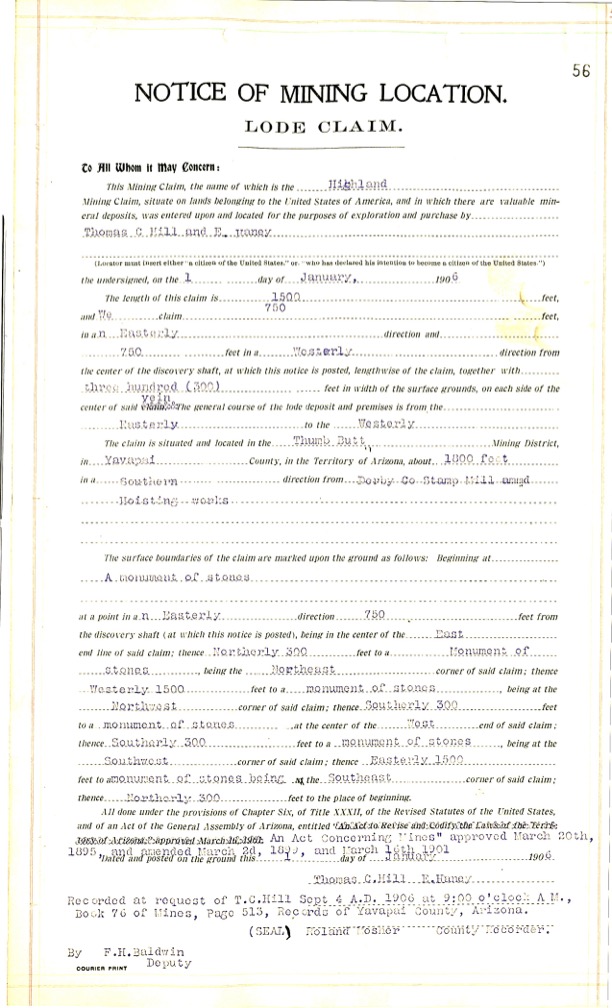
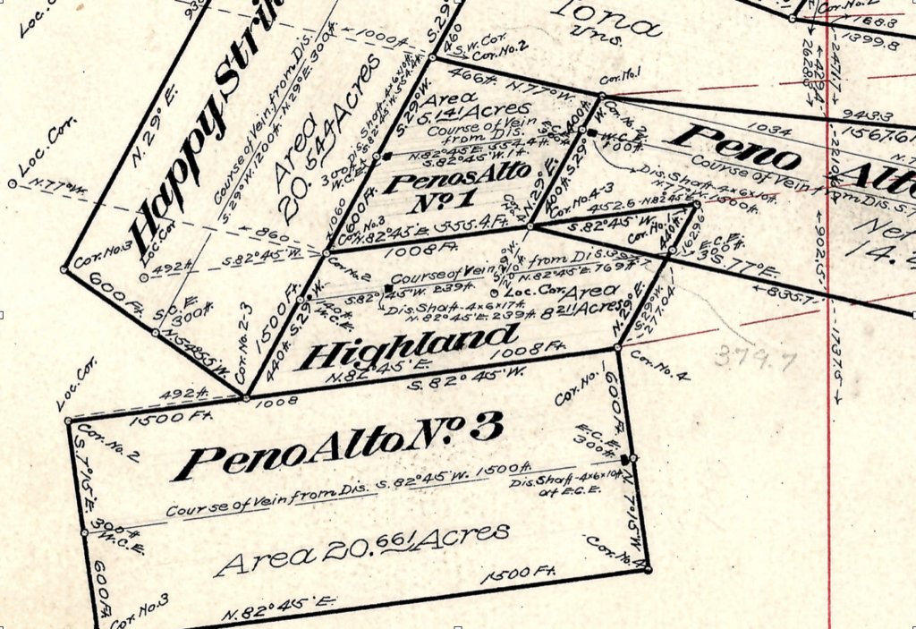
Highland x Penos Alto No. 1 x Peno Alto No. 2
Highland Lode: The location notice of mining location for the Highland lode claim shows it was located by...
Penos Alto No. 1 x Highland x Happy Strike
Is the Penos Alto No. 1 valid if located in 1906, well after the Happy Strike, but purportedly...
Happy Strike x Puritan x Iona
The original Sept 9 1904 Notice of location for the Happy Strike lode provides a 1500’ x 600’...
IRON MASK x IRON MASK
Mineral Survey 2424 is comprised primarily of these amended notice of location records, that are still inconsistent with...
Puritan x Puritan 2
The original Notice of location for the Puritan No. 2 lode claim has the 1500’ distance running an...
Italian x Italian
Considering mineral survey 2424 far as any Italian lode claim is concerned…We are presented with the most recent...
Protection #2 x Puritan
The Protection #2 is platted at 950.8’ x 533.5’ by J.J. Fisher, however the lode location notice provides...
Knocker Doom x SunnySide x Great Eastern x SunnySide
The Knocker Doom Lode claim dated September 7, 1906, takes in 1500’ x 600’, 400’ east and 1100’...
Great Eastern x Surenough Lode Claims: Conflicted Locations
Point of Discovery The Great Eastern lode dated September 1, 1901, is depicted on M.S. 2424 at roughly...
IONA LODE CLAIM CONFLICTS: Puritan, Puritan No. 2, Happy Strike and Peno Alto No. 2
M.S. 2424 The Mineral Survey of record clearly does not accurately account for these pre-existing senior rights when...
The Graft Checklist
Information required when considering the purchase of mining properties: 1. Name of Property 2. Location 3. Acreage. 4....
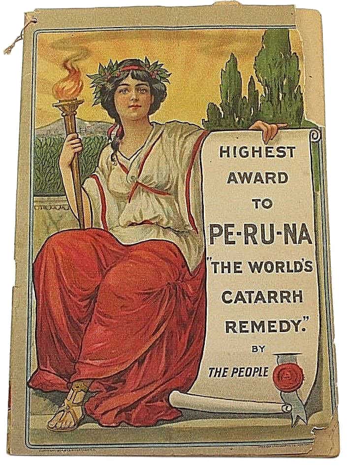
Mining the Investor: Remarkable Stock Sale Offer
The Arizona Republican, Wednesday Morning, June 14, 1916 A Clear Statement of the Remarkable Stock Sale Offer of...
Madizelle Mining Company: Arizona Magazine
From ARIZONA magazine: “In this issue will be found the stock offering of the Madizelle Mining Company, designated...
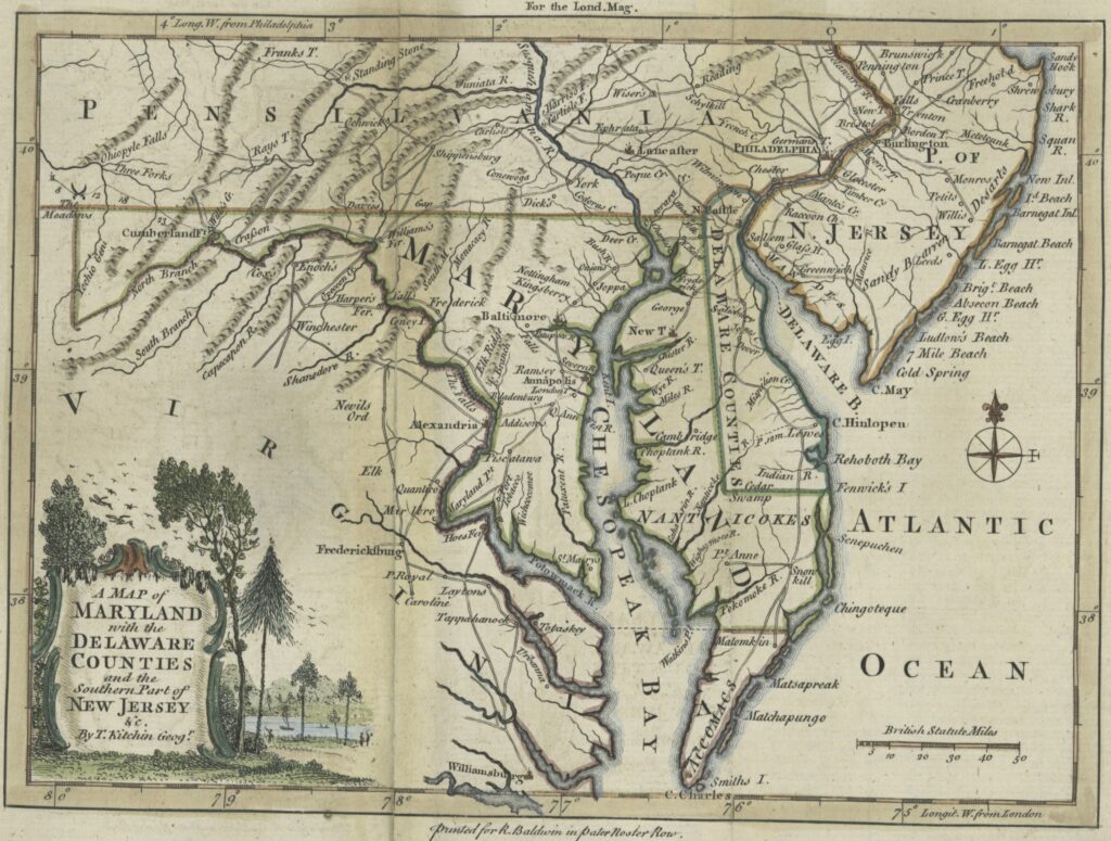
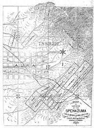
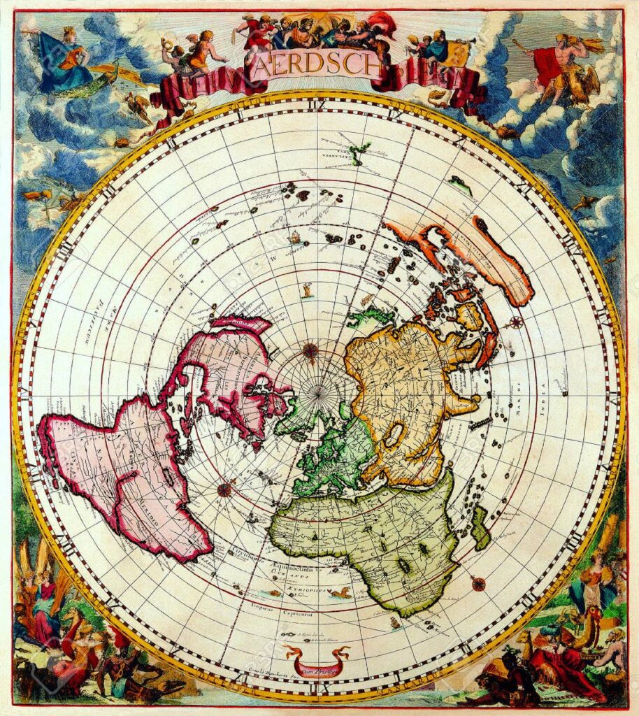
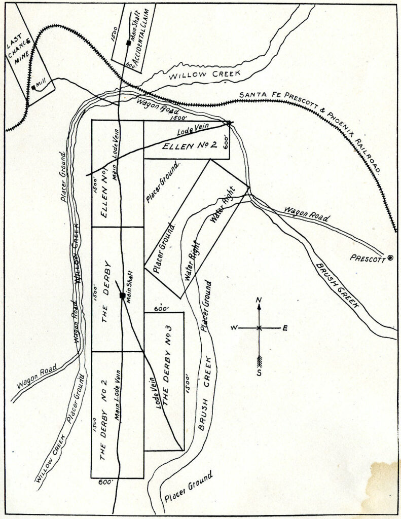
Pretty Looking ‘Maps’ of the General Land Office
Derby Mines The drawing above is likely a preliminary version of what became U.S. Mineral Survey 2424. What...
Ace in the Hole: MS1397 A & B 1899, J.J Fisher
John ‘J/J/’ Fisher’s Last Chance Lode and Mill-site, Prescott Arizona, Yavapai County October 27 1899 Mineral Survey 1397,...
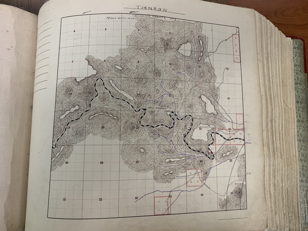
Mineral Survey 2424 MS2424 Prescott, Arizona Yavapai County; ‘Highland Pines’ >Enter the Unicorn<
The ‘PLAT’ shown above, Mineral Survey No. 2424, is fictitious. This is Sheet 1. See Sheet 2 below-...
E.M. Sanford letters re: Highland Pines land leased to George U. Young, Mr. Hill, James R. Lowery, E.L. Sharpneck, George W. Sarano
Way before the concept for Highland Pines in the early 1950’s was ever a sparkle in the eyes...
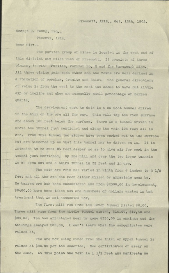
George U. Young ‘Puritan Group of Mines’ letter October 12th, 1902 Puritan, Puritan No. 2, Surenough lode claims
George W. Sarano was also the map maker of the 1903 Tributary Mining District of Prescott, and an...
Recommended
Top pic for you
Curious Case of ‘The Derby’
Put into ‘Evidence’ What lease is being referred to here in this letter from E.M. Sanford to George...
Yavapai County Treasurer’s Deed
No Redemption In 1947, A Treasurer’s Deed to the Highland Pines ‘premises’, Mineral Survey 2424 was issued and...
Follow the Yellow Brick Road
Stonewall Loeb George U. Young was an Arizona politician and a strategic planner who aligned his goals with...