Similarly, the Peno Alto No. 2 lode was located before the 1906 Penos Alto No. 1 clim, in 1905 and is described to be 2000’ south from Derby stamp mill and hoisting works.
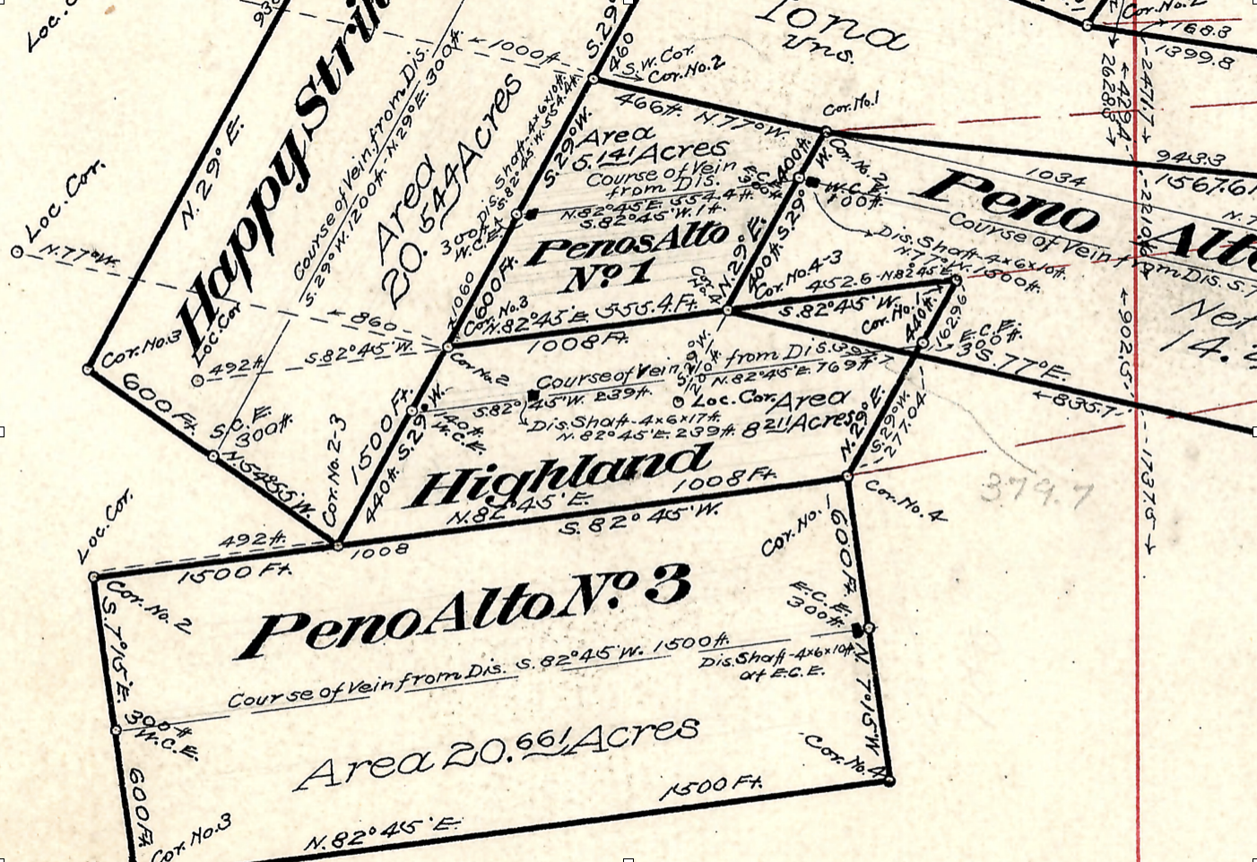
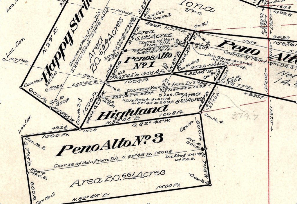
The location notice recorded for the Penos Alto No. 2 is also 1500’ x 600’ and runs an equal 750’ east/west from the discovery shaft. Now look again at the location of the discovery shaft depicted by Fisher on 2424. It is situated 100’ from the west corner end line and has a run of 1500’ northwesterly from discovery, and an additional 1500’ southeasterly from discovery…..a total of 3000’ feet in length, a sincere violation of the mining law maximum of 1500’ total per lode claim.
These location notices, are the only recording as to the original claim. There are no amendments, and it would not matter if there were, as they would also only be inconsistent with the mining law, if amended to reflect any the chaos that J.J. Fisher has created.
Below: The Peno Alto No. 3 Notice of mining location.
Above:
The Peno Alto No. 3 notice was claimed Nov 5, 1905, but recorded Jan 6th 1906 along with the Peno Alto No. 2 lode. The claim stated to be full sized and situated only 1000 feet southerly from the Shaft house and Hoist of Puritan mine of the Derby Co’s group of mines. (What Derby group are we looking for here?)
If the Peno Alto No. 1 and 2 are 2000 feet southerly of the same reference, how can the Peno Alto No. 3 be about 1000 feet to the north while M.S. 2424 depicts the location at a few hundred feet to the south of 1 & 2?
Correcting this to conform to the location notices would nearly reverse the Peno Alto 1 & 2 from the 3, or otherwise place No. 3, which is the last recorded claim, nearly entirely over the ground already claimed by other claims, effectively taking out the underlying ‘shared lode(s)’.
