Yet another shining example of a Yavapai County Mineral Survey No. 2730. Here we have the PLAT of the Claim of the Logan Copper Company, originally comprising of the Logan, Logan Ex., Copper Chief, Luckey, Lincoln, Lonely, Three Ridge, Seventy Two, Bay Horse, Bay Horse Extension, and Sure Enough No. 16, IN Copper Basin Mining District, Yavapai County, Arizona containing an Area of 215.471 Acres.
This subject was purportedly ‘surveyed‘ by J.J. Fisher September 21-25, 1909. The plat and field notes were apparently approved by Frank Ingalls dated December 22, 1909.
Some items to notate regarding MS2730: Sheet 1 states on it’s face ‘Approximate’ Township 14N, R3W, clearly claiming that this is ‘unsurveyed‘ area (how convenient). The ‘veins’ corresponding to every one of the Lode claims, all are clearly stated to be ‘presumed’ veins We also have some ‘amended’ location notices to sort out…Evidently a patent 534174 was issued with serial number 08016 in June 1916 to the Logan Copper Company, however there is a handwritten notation on the lower left corner indicating that only the Logan, Lincoln and Luckey were included, as (cancel others) is provided in an unknown persons handwriting.
We also can see a reference to a United States Land Monument bearing the same number as the Mineral Survey 2730 as a direct tie to the Lode claims….however there is penciled identification added at some point, by some unknown person, tying the body of lode claims surveyed here, to sections 30 and 31 of Township 14 North and Range 3 West G.S.R.M. , lying just westerly of Highland Pines, or the other work of J.J. Fisher and approved by Frank Ingalls, Mineral Survey 2424.

And here is what we are working with today with ‘Group 157 -Arizona‘:
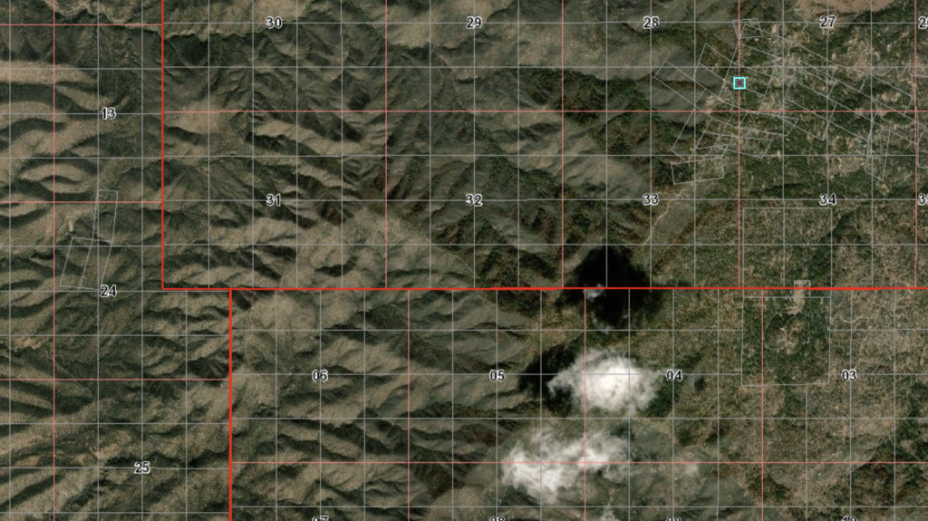
Not sure about the original houses, barns or offices, but the original location corners sure are interesting….as is the floating nature of the lode claims!