Derby Mines
The drawing above is likely a preliminary version of what became U.S. Mineral Survey 2424. What else could it be? They look nearly identical. John J. Fisher United States Deputy Mineral Surveyor is attributed to both plats, and field notes of the ‘survey’ MS2424.
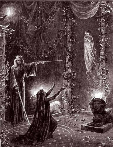
It is important to note the several issues inherent within this drawing. First of all, the drawing is titled ‘Derby Mines’ as a whole, but we know this, in this configuration, at this time, and located ‘there’ was not actually anything called ‘Derby Mines‘. Derby Mines, The Derby and ‘Derby Mine’ was a term for George U. Young’s stock certificate scheme to east coast residing ‘investors’ in his imaginary gold mining operation. This illustration is merely a future concept, taken from his early transfer of the Lode Claim ‘Derby Mine’ as early as 1902. The plat above, as is, is purely conjectural in nature. The future concept was to instill the fictitious gold mining operation into the minds of his investors that could not physically verify the operations existence on the ground from places like say Connecticut.
A prospector, or shall we refer to a mining operator, was better off with a representation of a large grouping of claims that did go to or could potentially go to patent for the surface estate, ensuring the credibility of the miners claims. Claims of Gold, mineral wealth, claims of valid claims, claims here, claims there, claims everywhere in this err….a. The check off list for how to dupe investors virtually required a depiction like the the one shown above, even pre-patent, enforcing the concept in the investors mind.
Where is It?
The prospectus for Derby Mines circa 1902, provides for a completely different concept of the initial Derby lode claim, in a different orientation, in a different area of the township, lying in a different direction, but nonetheless also in a theoretical configuration, theoretically near the ‘Last Chance’, theoretically sharing the same vein with Young’s ‘Accidental’ Lode claim, all touching an unknown placer claim, East of Willow Creek. In fact there are at least four different documented locations for George U. Young’s ‘Derby Mine’ as it stood to be at the time from a single initial Lode Mining Claim, which of course is simply impossible.
The next line reads ‘Property of George U. Young‘ which is also not possible at that time. The land identified here, as shown above, was a legal impossibility, per the mining laws, especially in 1907. There appears to be some initial mineral estate claims by third parties, in this region, that were leased by Young, which likely had their own inherent mineral estate issues, if they were ever valid to begin with, which lasted beyond 1907, at the site we are led to believe this paper creation existed and lies present today.
Even if the above claim jumper surface configuration was actually valid and existed as it presents itself in 1907, the title was held in the U.S., in the Prescott National Forest. At best, only a mineral estate could have been held as an interest by Young. However, the facts surrounding this depiction do not even support the mineral estate interest, and that of one being legally held by Young, and existing as a surface right, like the above drawing, there, or present day…here.
We are led to believe, per this depiction, that there was a mining claim interest that looks like this, in Yavapai County Arizona, in Township 14 North, Range 3 West across sections 28, 27, 33 and 34, which would have been in the later established Thumb Butte Mining District during this era. We are assuming something was initially valid, patented to the surface estate of something, per serial patent 818945 in 1921, and is well ‘here’ at the ground we want to believe it lies present day, a magical place called Highland Pines, lying just outside of Prescott, or per gov mapping ‘Highland Park’.
We are being told this area is the same thing it lied at in the township range and sections, prior to and at the time of a patent, that was supposed to pass title by way of the 1907 MS2424 to a private property of 419.692 acre spread, or depending on your interpretation 388 some odd acres of something, in 1921 -lying somewhere.
Township Sections
The question has to be asked: Where exactly were sections 28, 27, 33 & 34 in Township 14 north Range 3 west G.S.R.B.M. in 1907? The only Township survey of record in 1907 was filed by S.W. Foreman and signed by Surveyor General of Arizona John Wasson in 1871. S.W. Foreman is listed as one of several documented Benson Syndicate fraudulent surveyors. This 1871 survey and plat does not provide for what we are looking at in the prelim, or present day placement of MS2424 spread.
According to the field notes of Foreman for this original township platted in 1871, in which Mineral Survey 2424 is based upon, and can only be based upon, the sections identified in J.J. Fisher’s drawing do not support the same section corners as being where the same sections are represented to be present day. READ IT.
Even if the plat was not conjectural in nature, there is a conflict between the associated section lines and corners in relation to the very lode claims as presented, the LOCUS of the dare we say ‘tract’, between Foreman’s survey and the resurvey Plat of the 1930’s, otherwise referred to as ‘Kinsey’. Neither Foreman or Kinsey is correct, or legally supported by anything that will hold under the light of day.
The Lodes as depicted
Pay close attention to what is being referred to as corner 4 to corner number 1 of the Peno Alto No. 3 lode claim. It is shown to be N 7 degrees 15 east 600 feet, going from corner 4, back to corner 1. Going from corner 2 to corner 3 of the same Pens Alto No. 3 reads N 7 degrees 15 west. Going from corner 3 to corner 4 -reads N 82 degrees 45 east 1500 feet. Where is North?
Fisher has depicted several ‘creek’ or ravine lines running through and adjacent to the body of lode claims as represented here, which we can and should deduce also apply in consideration of the latter Mineral Survey 2424 just the same. It is impossible to lay this same configuration into the areas of land as they are represented to exist within the confines of, present day, per MS2424 and this preliminary plat, and come to the results as shown here, with or without the reference to creeks, etc..
Put another way….there are mountains where the creeks are supposed to be. There are creeks where the mountains are supposed to be. None of any of this conforms to the lay of the land on the surface of the earth, anywhere in Township 14 North Range 3 west, especially where present day Highland Pines is platted to be, within these very fictitious mineral lode ‘claims’.
Neither the final Mineral Survey 2424, not the preliminary plat as shown above conform to the Mining Act, any territorial statutes or even local district regulations (that could not overcome the basis for the lode claim act). The representation above completely ignores the very lode claims it is supposed to be comprising of.
At best, the senior rights to the mineral estate are being completely overlooked. The dimensions of the claims are being ignored entirely. The placement is not taking into considerations any of the facts of record. The directions all point directly to within oneself, and not anywhere externally, on the ground, like in a National Forest.
Mineral Survey 2424 in Comparison
J.J. Fisher purportedly created MS2424 utilizing 2 separate General Land Office sheets. The Derby mines, runs on Sheet 2 and something else is created with Sheet 1. Sheet 1 is signed by Frank S. Ingalls, and there is no approval signature on Sheet 2. Both sheets are acknowledged as the whole of MS2424 in the serial patent. The serial patent does not allow for entry to land in which the prerequisite rights are held by others, or the passing of surface estate to something other than that true something, all following the law (actually existing and there).
Camp Young was not Young’s camp. The placement on the preliminary plat above does not coincide with the field notes of MS2424, but Fisher created both. Okay it’s a drawing, but it’s also just a drawing. The ground that was blanketed with the conceptual lode claims and their relation to the camp building, does not conform to the preliminary 2424 plat, and neither the prelim plat, nor the final mineral survey support one another.
The drawing above has all of the claims combined into one plat, however the latter MS2424 plats that encompass 2 sheets are depicted to create something else. That something else could not form the combination result of the blend between Sheet 1 and Sheet 2 MS2424. Irregardless, we got the combination….yet another layer to the conjecture at hand. The key takeaway form the reference to the word ‘conjecture’ is the word ‘con’.
Highland Pines was platted in the late 1950’s and 1960’s utilizing various county approved plats A through G, that place neatly designed deeded lot splits inside the conjectural lode claims, that are like the ones presented above. This…is of course, assuming—a—lot! A chain of deed is meaningless without title. Deeds that reference theoretical title are not valid deeds. Deeds to private property are not deeds without private Title. To have private Title, you must have private Title. Title is Title.
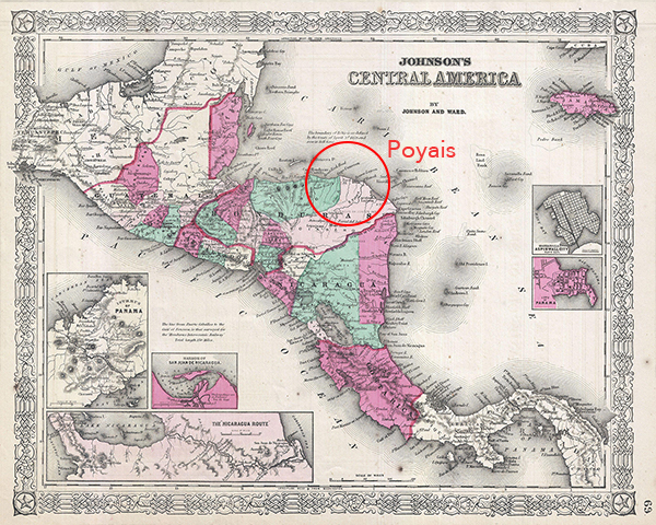
Gregor MacGregor’s ‘Country of Poyais’ in 1821