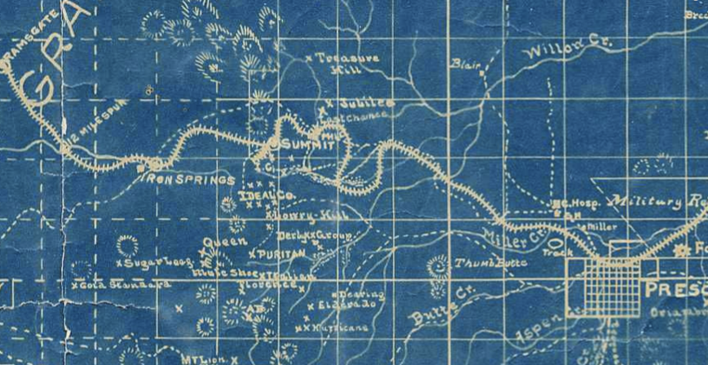

The ‘PLAT’ shown above, Mineral Survey No. 2424, is fictitious. This is Sheet 1. See Sheet 2 below-
Theoretical Survey Plats
At first glance there appears to be quite a lot going on here with MS2424. What an intricate survey map to disect. How exactly did this come into configuration? So many questions, so many answers….But the bottom line here, at the end of the day, is it is all an illusion. There is actually nothing going on, here, at least not anything of true value. The above drawing is a mere cartoon.
Nonetheless, by the ‘official’ record(s), this is the plat illustration of the purported ‘survey’ that was completed by J.J. Fisher June 20-30 in the year 1907, a U.S. Deputy Mineral Surveyor. Mining surveys of record, completed with not much more than a touch of fairy dust and a pen tool, in an office, were common practice during the pre-regulation era, the reign of the Benson Syndicate, and the unwritten policies of commissioner Binger Hermann. The same policies known to have caused nothing short of ‘cadastral mayhem’, tying up land titles since the 1800’s.
Fictitious Ties
The plat is essentially an illustration of the official ‘field notes’ of ‘survey’, and both should be consistent with each other, representing the whole, a legal whole. In in this instance, it simply does not matter. This is not a situation wherein there is an error, or a discrepancy, or an inconsistency in the record. The record itself is fictional. The ties to the ‘claims’ as drawn on the plat and referenced in the field notes are entirely theoretical in nature. Another way to say what we are looking at here is, that this…area…never…left…nature.
The orientation in this instance is not entirely the issue, but is in so many ways is the issue. One of the key indicators, or red herrings, is the section lines that are colored in red ink, that are supposed to represent the mining claims ties in relation to it’s overall mathematical positioning in the township. This drawing is leading us to believe that there exists an MS2424 that followed all of the rules, regulations and laws at the time it was surveyed, and exists in a certain position inside the Prescott National Forest, effectively an island surrounded (landlocked) by federally titled land. The areas within the exterior boundaries in bold black ink are supposed to represent private property, earned under the Mining Acts of 1863 and 1872 respectively.
Enter the unicorn.
Below: MS2424 Mineral Survey Sheet 2, Highland Pines Arizona

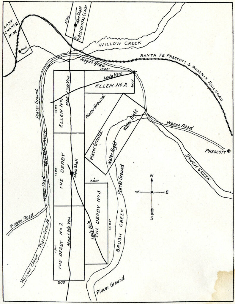
Reference the above depiction of The Derby Lode Mining Claims with the Ellen Lode Mining Claim, in proximity to and sharing their respective ‘veins’ with the ‘Accidental’ Lode Claim. Confirm the record orientations of the lode claims individually, re apply the information to the configurations and relations to the ground area in the township, notably wherein Willow Creek is drawn and ‘Brush Creek’ is drawn with a placer claim touching the Derby lode claims. Visit the last chance and Accidental lode claims, any patents applied to the Last Chance against the record and you will begin to see the inception.
Now review the above Sheet 2 of MS2424…apply the orientation to the present day ground, review the red ink lines on the MS2424 Sheet 2 and Sheet 1, North-South-East-West……as you can see something is not right here. But what is it exactly that is not correct? What are we looking at here and how did this happen?
In order to have any chance at reflection, we must be working with all of the information. All of it- Even if it is wrong. So we must go back, way back, to before any of this could have even come into position, if ever did. Prior to the mining act of 1872, prior to 1866, the effective basis of the territory in nature. However, since we are looking at a mining claim, from a mining survey in 1907, we can deduce that the picture is supposedly deriving from a survey in accordance with Mining Act of 1872, so we must try to go off of that as the premise for the construction.
Notice of Mining Claim Location
Also known as the Lode Mining Claim Notices, which are typically recorded with the county where the claim resides, and often on file with the General Land Office, which is present day Bureau of Land Management, especially for those claims that went to ‘Patent’. The lode claim notices for the claims in MS2424, the history of those particular ‘claims’, their purported ground locations, their ownership as mineral estate, their ‘amendments’, size, orientations, etc., simply do not allow for Mineral Survey 2424. Nor would they ever, even if valid, and there, on the ground, where you think ‘it’…uhm…lies.
In the case of MS2424, the configuration of the lode claims, even if valid, would not and do not come to form the end result, by their very record. Nor has it ever. Additionally, the documented history of the land in Township 14 north, Range 3 West, wherein the present day placement of the ‘MS2424 property’, which has conjecturally existed for over 100 years, supports the present day position as being entirely erroneous, by the very record that is supposed to be the underlying basis for the record(s) that follow it and it’s placement to the earths surface for a ‘survey’.
Said another way, way before Highland Pines, or should we refer to the area as Highland Park?…The issue(s) touched on above were present. It is the very fact that the issues were actually issues, and major issues to overcome at the time, and for reasons of historical value, that we can question exactly how MS2424 could have come into formation, even though it never did. This is all rhetoric, as the factual content in which is being discussed here is none other that of fraud. A case of clear fraud, that is at a glance…well, not so clear.
Looters of the Public Domain
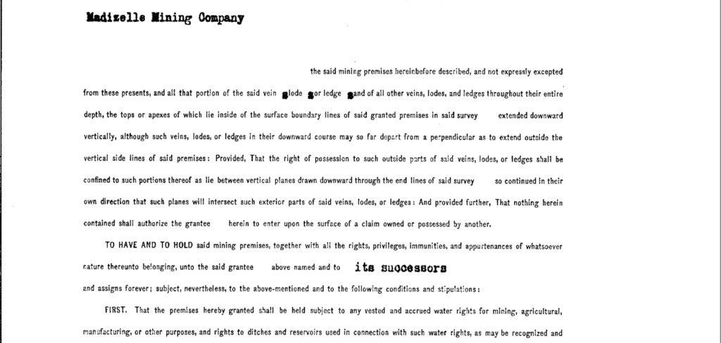
A concerted effort to obtain the land, spanning many years, employing all the tricks of the trade. An exertion of will to obtain patent to all 419.692 acres of U.S. titled property, relinquished under serial patent 818945 to the Madizelle Mining Company, not in 1907, because there was no Madizelle incorporated in 1907, but many years later, after the politics of the territory and statehood, not to the alleged claimant that is written on the face of MS2424, Mr. George U. Young, but ultimately to Madizelle Mining Co.. The final patent only contained 388.42.
The Patent deed has the value of a quit claim deed, and assumed compliance with the rules, prerequisites, regulations, and laws, per the congressional act(s). The Mineral patent deed also assumes the survey is real. The Mineral patent also assumes the location is accurate, as are the representations made by the application for patent to be issued. With all of that being said, the language contained with essentially all of the patent deeds of this era, support the above assumptions (the mother of all….), but ultimately cover and is in favor of the U.S.. In any event, any prior valid occupied mineral estate ground that lied within the confines of the supposed open mineral estate (government title), would have been excluded from patenting of the surface estate, or private property rights to the ground after the date of patent. In all likelihood, if any of this had been presented or represented legally at the time of application for patent, a patent would have never been issued at all. All signs point to No.
Even if the claims were made to not overlap, were actually there on the ground, on those particular hills where it is shown to be present day, with valid title surveys supporting clear title, invoking the 100+ year ‘chain of deed’, we run into the main issues of validating the relocation and original junior vs. senior title rights that existed at the time of this patent application. A more insidious omission of George U. Young on behalf of his made-up Madizelle Mining Co.. An intentional omission, not one of negligence.
A concerted effort between Young, Sarano, Lowry, Hill, and E.M. Sanford. One to keep the stock investors coming in, and a finalization to the grounds story, by way of added certainty to con the east coast investors, one of official U.S. Patent ‘deed’ to support the tale. A story to become legendary, one of mining tales like so many before, during the westward expansion, in the pre-regulation era, at a largely barren situs of rocks and dirt, inaccessible by so many to confirm any physical existence of say…Gold.

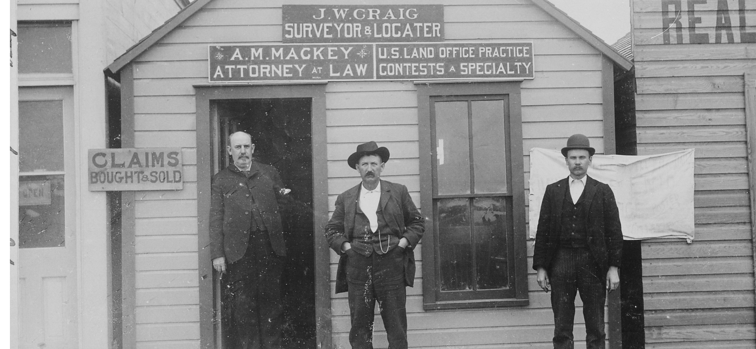
So here it is Below: Two term Yavapai County Sheriff James R. Lowry (Lowery, Lowry-Hill), who followed Bucky O’neill, leased the site to George U. Young, prior to his end in the line of duty in 1916. The 1907 MS2424 PLATS Sheets 1 & 2 were used to apply for patent to the same area of land in 1920, by Young, for alleged senior rights to the Madizelle Mining Company. Although, at best, MS2424 could only be based off of the (fictional) 1871 Foreman/ John Wasson original township survey, positioning sections 28/27/33/& 34, which when applied accordingly, makes this (MS2424) not there (present day site), even if it (MS2424) was valid.
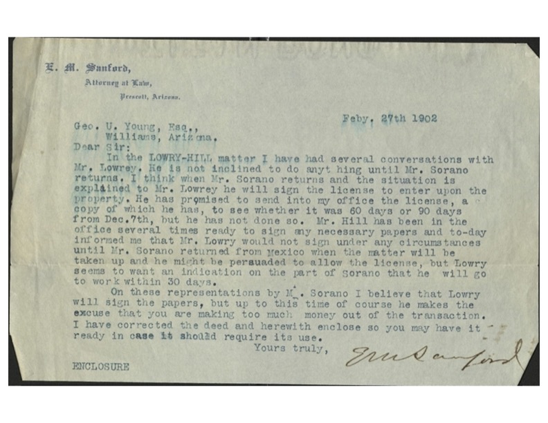
Above: Signed by E.M. Sanford -attorney, Prescott Judge, District Attorney, and Yavapai County Mining Claim investor/owner & promoter
Herein lies the larger issue, the unseen issue, the discrepancy so large, so insidious, it can only amount to a clear case of fraud. What is not so clear at first or second glance, but by it’s own record, with all of the information, the shadow is identified. Truth must and shall prevail.
Assuming all rules regulations, prerequisites, official records, laws and intentions are kosher, the patent deed could have only conveyed largely junior interests at this site, but in actuality, according to the record, did not even do that. The survey is a blunder, the claims, and as senior, are an impossibility, especially as represented in the plat and field notes (which has walk lines that ‘begin’ wherever you believe it begins), a clear legal nullity from beginning to end.
The amendments are amending nothing. The amendments are not effectuating all out relocations even if the amendments were amending something. Ultimately, the revisions did not form MS2424. MS2424 does not follow the records that are apparently comprising MS2424. The dotted line is irrelevant. As a matter of conveyance, by way of the inception instruments, this Title…never…came…into…formation.