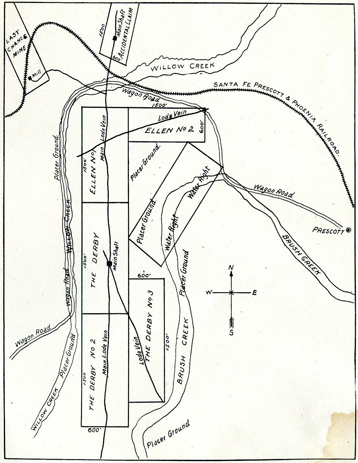
North, South, East, West positions of the Derby Mine, Ellen Mine, Accidental Mine, Last Chance Lode Claims Prescott, Arizona.
This map was used to sell stock to investors as a part of the Derby Mining Company’s Prospectus in 1902. The configurations of the claims are inconsistent with the record Notices of Mining Claim location, the purported ground locations of the claims, the mining law, and further inconsistent with Mineral Survey 2424, drawn by J.J. Fisher in 1907.
Ground Locations per Notice
Pay attention to the illustrated and written relation of the Derby mine in relation to the positions of the Last Chance, Accidental, Willow Creek, Prescott, etc.. The Main Lode Vein of the Derby running north and south as a centerline appears to be shared with that of the Accidental Lode Claim, nearby. The Ellen No. 2 and the Derby No. 3 lode veins are appearing completely inconsistent with the claim boundaries and the allotment offered by the mining law.
One Comment
Comments are closed.