This is the Notice of mining location for the lode claim ‘Protection’. It does not say Protection #1, it is simply Protection.
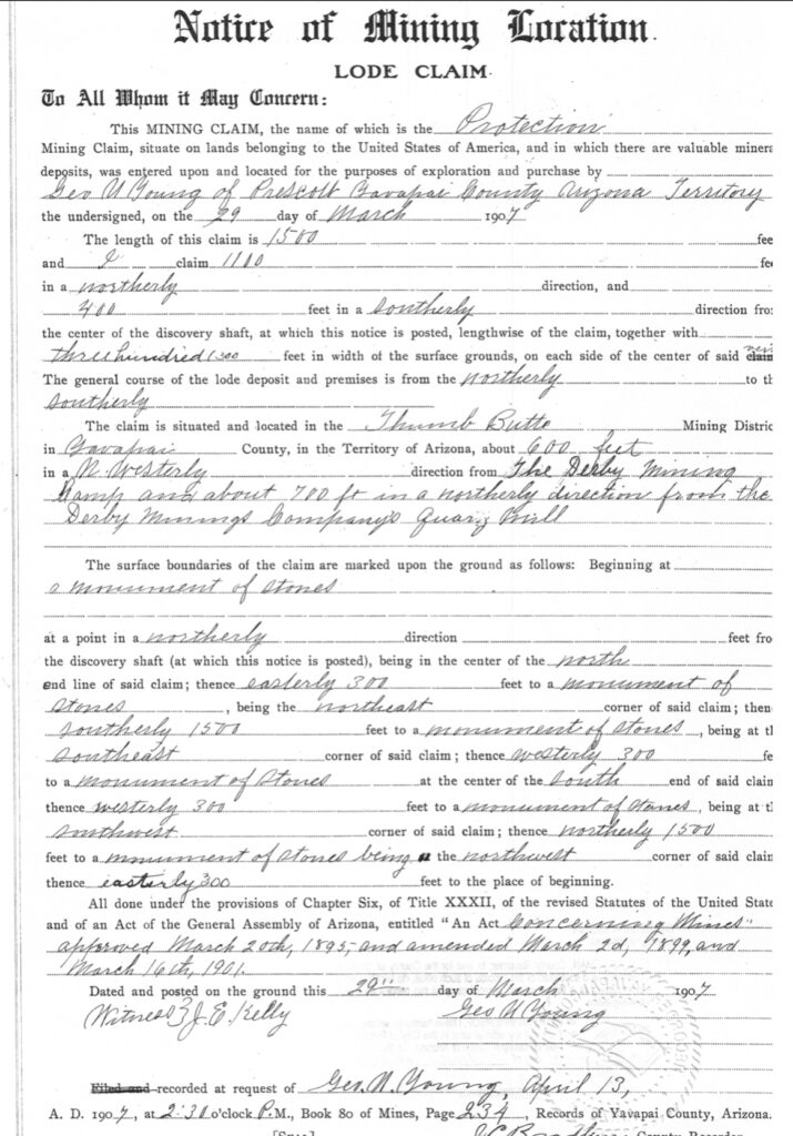
It was located by George U. Young March 29, 1907, recorded by Young April 13, 1901 at 2:30pm.
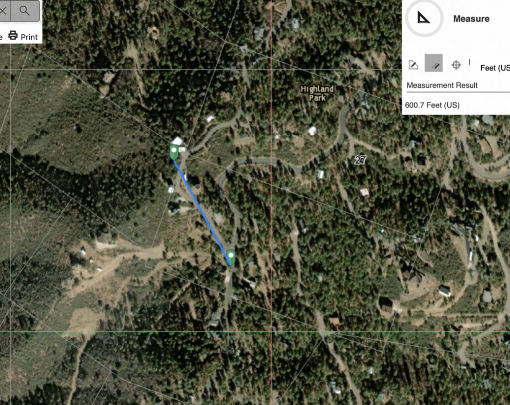
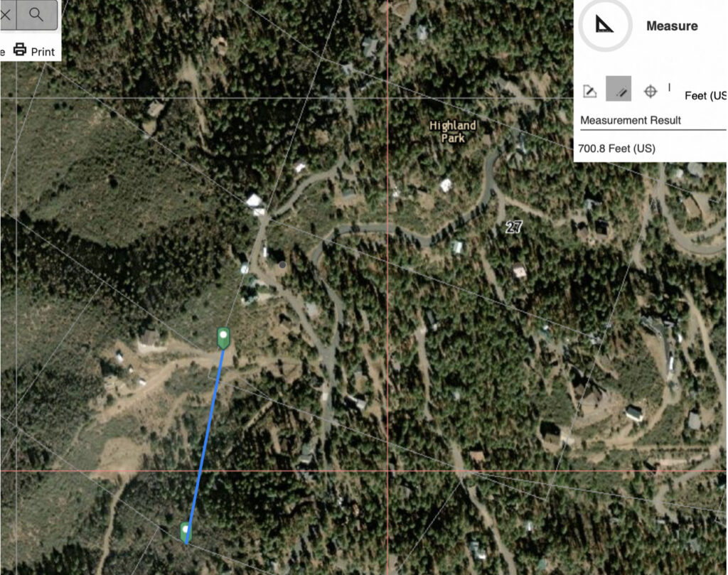
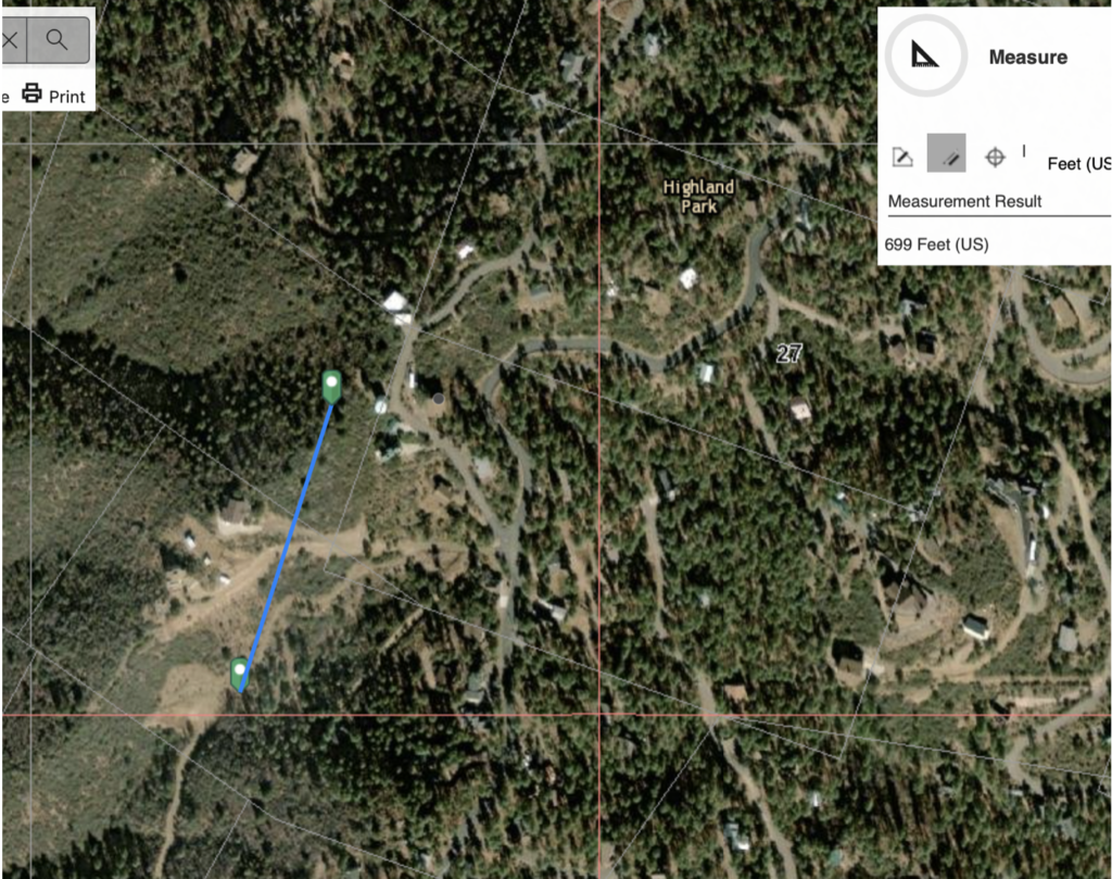
This is a full sized 1500’ x 600’ lode claim, except instead of running east/west like the Protection #2 & #3 lodes, this Protection claim sits in a north/south position, and at about 600’ in a northwesterly direction from the Derby Mining Camp and about 700 feet in a northerly direction from the Derby Mining Companies Quartz Mill. See images below indicating where this claim would be on the ground if present day depiction per M.S. 2424 and subdivision was accurate, and we can assume Young was speaking to his theoretically ‘relocated‘ Puritan lode and the leased improvements, and/or fictitious mill location in 1907, per 2424 field notes.
This lode otherwise, if real, has senior rights as it was located and recorded prior to the Protection #2 and Protection #3 claims, but after the Humbert and Italian claims. There is no mention in the M.S. 2424 field notes about a Protection lode. The locator was silent and did not make any adverse claims while Fisher ignored the Protection, and made a ‘patent survey‘. No one looked, there may have been no monuments on the ground in this area to begin with to look for. Why would George U. Young ignore his own underlying senior claim? This situation speaks for itself.
Look at this claim notice closer:
It states 1100’ running northerly and 400’ running southerly from the discovery shaft. This claim, like the rest, was equally ignored. It’s true intention will likely never be known, but does it exist? Does some portion of this claim exist after say…a patenting?
Both the Protection #2 and Protection #3 claims were located at 1500’ x 600’. Mineral Survey 2424 has depicted both claims at a length on only 950.8 feet. J.J. Fisher has depicted on 2424 what would otherwise, without any conflict, be the true west end corners and monuments against his truncation at 950.8. There is no explanation in the 2424 field notes for this action. The claims do not reflect the Humbert west 50’, but calculate out as he has platted, which is something different. The present depiction on the ground and the depiction in recent surveys, is simply inaccurate, even if M.S. was factual and on the ground, around there.
Could be alt. 700’ distance to the claim generally, possibly centerline of 1500’ begins at north. It is all wrong.
A separate note: Ignoring the Protection claim, the Protection #3 is being represented at present day only 917’ distance, this is beginning at 72’ too far west as an accepted corner/monument for this ground location presentation of MS 2424, & inconsistent with the very official plat and subdivisions of record that are being referenced in the surveys. Which are theoretical to begin with.
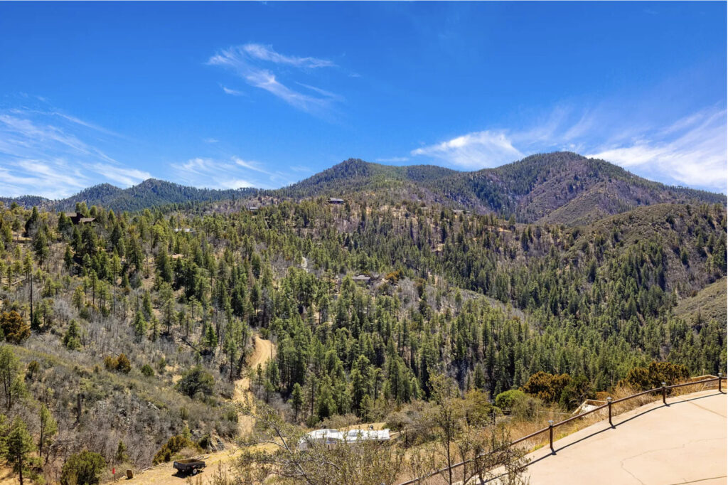
According to M.S. 2424, this would be looking southerly from the NW Puritan ground, overlooking the lode centerline at bottom of image where the RV is parked.
West Spruce Mountain in background. Current Section ’33’, T14N, R3W, G.S.R.B.M.