Considering mineral survey 2424 far as any Italian lode claim is concerned…We are presented with the most recent recording from 1904, claimed by George U. Young, which is the version incorporated into M.S. 2424 and patent.
A full sized mining claim, the claim running at a variation of only a 15 ft. between the Notice and the M.S. 2424 Plat. Not a big deal.
The issue is more whether or not that final location of something called ‘Italian’ as depicted to be somewhere on the ground was actually allowed to be claimed by George U. Young, there on that ground, in 1904, and as the Italian in Thumb Butte District, without interfering with existing rights, or any leased mineral estate of James R. Lowry. Remember this is all unpatented ground, nothing of record supporting anything to the contrary.
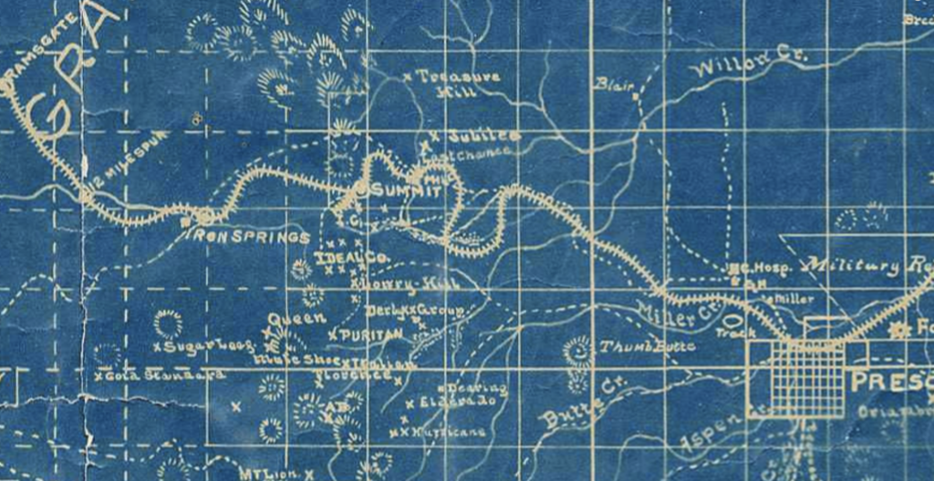
There is again no explanation by Fisher or accounting for the truncated Italian dimensions as depicted in his Mineral Survey 2424. The Area section in Field Notes lists a less conflict with ‘Puritan’ of only .18 acres.
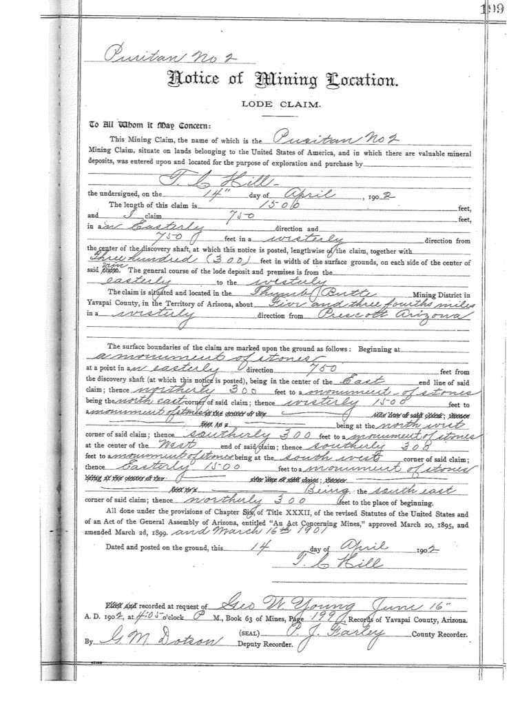
There is also a conflict as depicted on the Puritan No. 2, however there is no reference to this conflict in the field notes. Likewise there is no conflict accounting for the Puritan No. 2. The Puritan No. 2 from 1902, is showing only 18.556 acres instead of 20.661 acres, by the time Fisher creates M.S. 2424, with the 15ft increase on the westerly end line form the discovery shaft. This is a bigger deal.
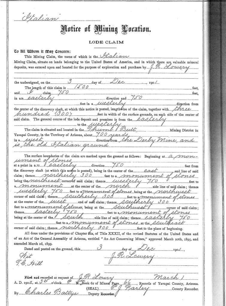
This Italian notice claim is situated 600 feet northerly from the mouth of the ‘upper tunnel’ on the Puritan mine, which it parallels on the north and is about 700 yards in a westerly direction from the Derby mine and is the “old Italian ground”.

Below:
The Italian Notice of location that appears to be the original notice claimed by James R. Lowry dated Dec. 3, 1901. The claim is a full sized 1500’ x 600’ claim, running 750’ east/west from the discovery shaft. 750’, not 300 west and 1200’ east of the discovery shaft per George U. Young claim for Italian in 1904. (this is the old Italian ground) yeah, exactly, wherever that is, was or supposed to be, or still is, or should be. Even if you want to believe this is the same discovery shaft identified between the different location notices for the Italian Mine, Young was not able to locate over the original leased land of Lowry’s Italian lode claim, it opens up additional conflicts, is not in accordance with the map below placing an Italian over a mile to the south, etc., etc., etc.. The variable negates any purported lode, vein, or ledge.
Is the 1904 Italian notice actually supposed to be a new location in a different location in the township? Is that location consistent with the M.S. 2424 platted location? There is not any amendment of record, or relocation of record, and the claim does not just float away to another location. Could this claim be legally located where there was pre-existing claim to the same leased unpatented claims of the ground of Lowry-Hill & Ideal Co., per the lease from Lowry?
Was the Original location valid? Was the 1904 location valid to begin with? How could it be?
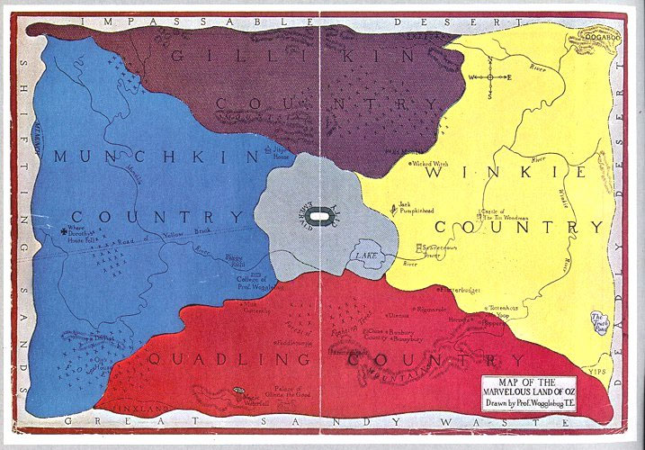
There is no indication that the Lowry Italian notice location was at or near the Lowry-Hill group. The Lowry-Hill Group report by Sarano, does not mention Lowry’s Italian claim, the Sarano 1903 map indicates a separate Italian mine 1 mile+ in a southerly direction from the Lowry-Hill group, at about the south boundary of the T14N R3W. This location is likely to be ‘Italian Springs’, surenough.