Curious Case of ‘The Derby’
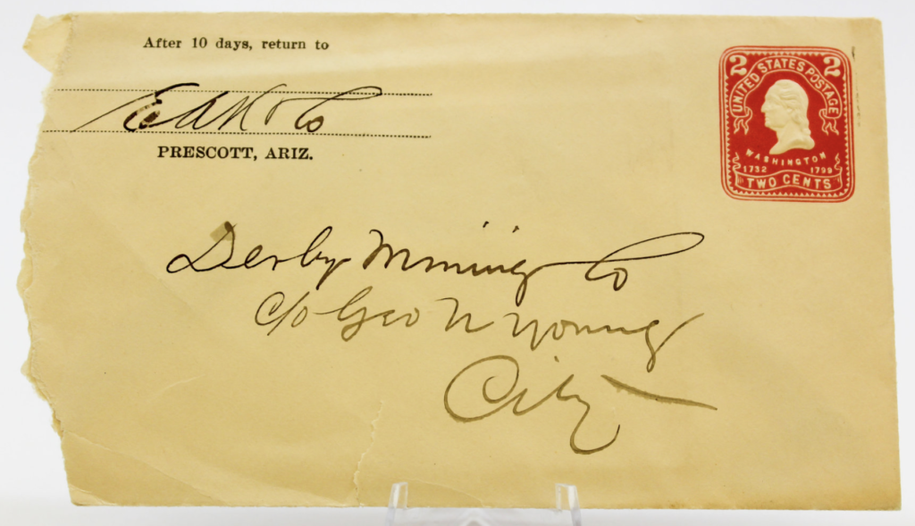
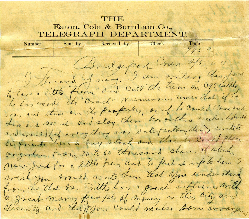
Put into ‘Evidence’ What lease is being referred to here in this letter from E.M. Sanford to George...
Yavapai County Treasurer’s Deed
No Redemption In 1947, A Treasurer’s Deed to the Highland Pines ‘premises’, Mineral Survey 2424 was issued and...
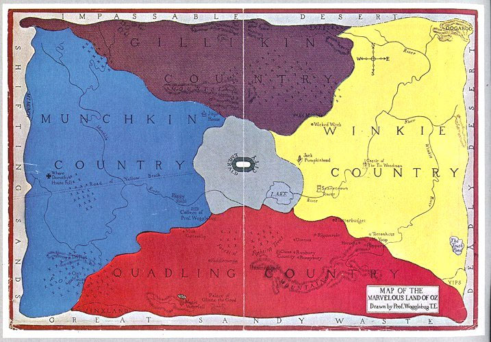
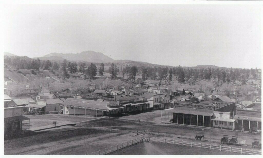
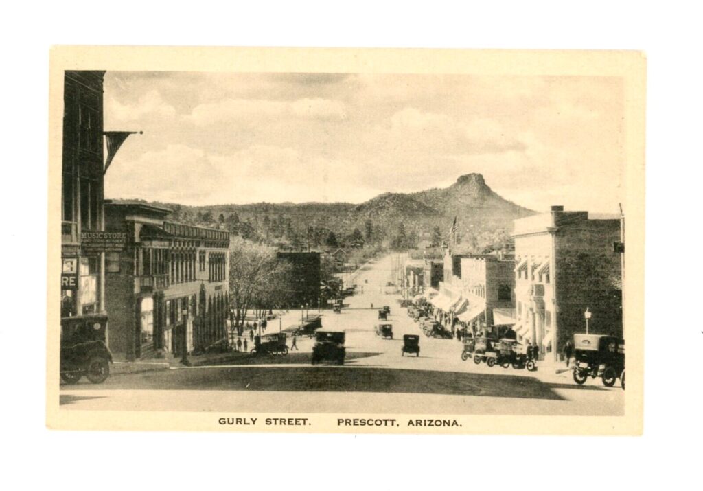
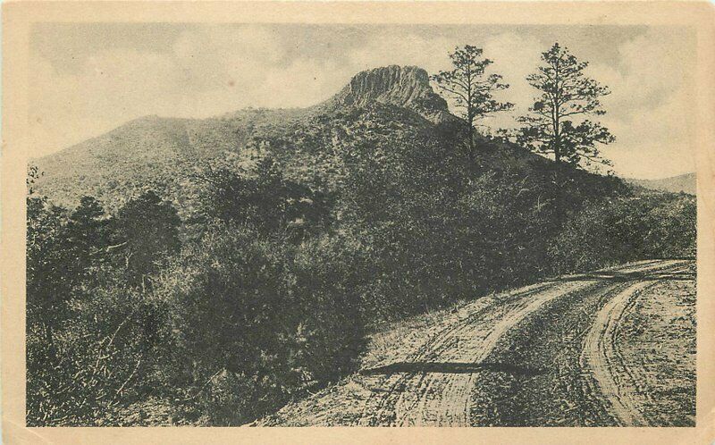
Follow the Yellow Brick Road
Stonewall Loeb George U. Young was an Arizona politician and a strategic planner who aligned his goals with...
A land patent to Air.
First Impressions The U.S. land patent 818945, is in essence a quitclaim deed to nothing~that exists nowhere. Amongst...
U.S. Patent Deed to Highland Pines
The Puritan #3 and the Protection No. 2 Lode Claims The original application for U.S. mineral land patent...
Renting the Lowry Claims
The Golden Rule The Derby, the Madizelle property and the Lowry claims are all one and the same....
The Rule of 3: No. 1
Puritan, Peno Alto, Derby Creating is fun, creating in three’s is even more fun! The rule of three...
What’s Done in the Dark
How the Derby became the Madizelle Derby Mining Company, a corporation, by George U. Young its president, (E.M....
Entitlement to a Mineral Patent Under the Mining Law of 1872: Mineral Survey 2424
“U.S. Department of the Interior Memorandum M-36990, November 12 1997, Entitlement to a Mineral Patent. Introduction and Overview...
25 Mining Claims Bought & Paid: July 1, 1920, Madizelle Mining Company, United States Land Office
Attorney in Fact Department of the Interior Mineral Entry No. 045620, United States Land Office Phoenix Arizona, Application...
Madizelle Mining Company, claimant 419.692 Acres of Land: $2,100.00
IN RE Mineral Application Proof of Sums Paid ‘To the Receiver of the Local Office for Land’, $2,100.00...
OHIO Lode Claim @ Lowery-Hill Mine: Norman Hale & S.P. Hill, 1901
LODE-VEIN LOCATION Norman Hale and ‘S.P.’ Hill Notice of Mining Location dated January 21st, 1901 for the OHIO...
The Cook’s are Booked
Pre-Mineral Survey 2424 Final entries that would one day become the foundation for J.J. Fisher and Frank S....
Land Conscience
Thievery Corporation ‘There is one part of the surveying business that Benson had down pat, and he has...
Imperial Entanglements
However rich Arizona mines have been, there is a suspicion that, before the days of copper, their net...
‘Brevity is the Soul of Wit’
Retracement Surveyor Beware, Fraudulent surveys may be anywhere The recent article in the July/August issue of American Surveyor...
Royal A. Johnson U.S. Surveyor General Arizona Territory 1892 Instructions for Deputy Mineral Surveyors
“Before undertaking any official business, you are expected to make yourselves throughly familiar with the mining laws, and...
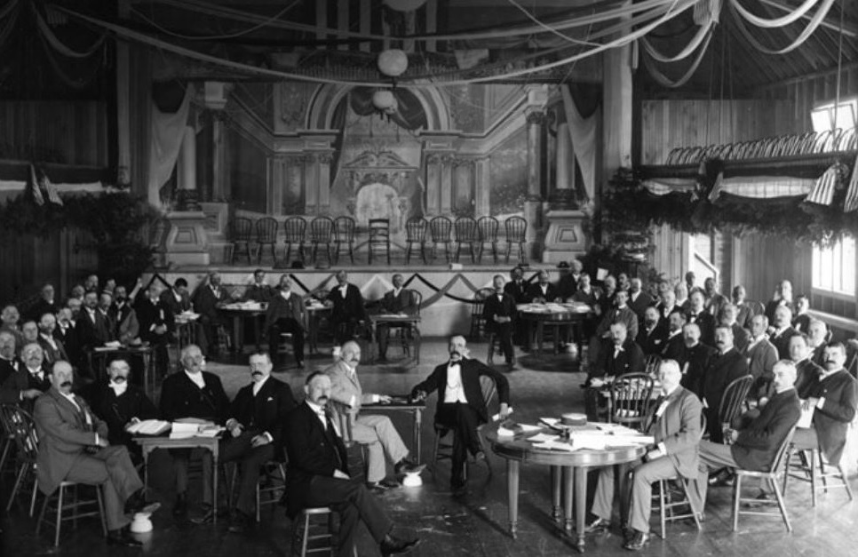
SKULDUGGERY ‘The Derby Mining Claims’: Progress Report Dec. 14, 1906
A fictitious ‘progress report’ on The Derby Mining Claims Thumb Butte District Yavaai County, Arizona, U.S.A. by Booth,...
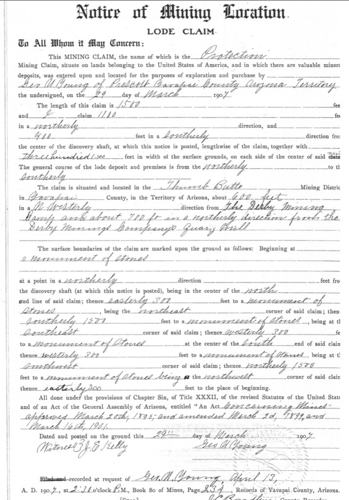
Protection Lode Claim
This is the Notice of mining location for the lode claim ‘Protection’. It does not say Protection #1,...
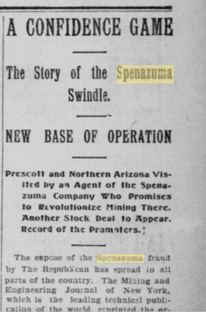
Madizelle x the All
A confidence game: The Story of the Madizelle swindle. Base of operation, The (former) Derby Mining Company, Prescott...
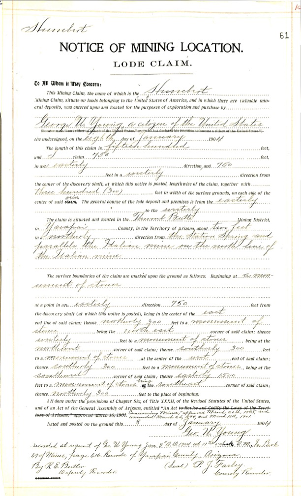
Protection #3 x Humbert x Protection #2
The most easterly 50’ of the depicted Protection #3 would actually be the Humbert lode, senior in right....
Humbert x Italian
There is a location notice recorded for the Humbert lode claim dated Jan 8, 1904, located by George...
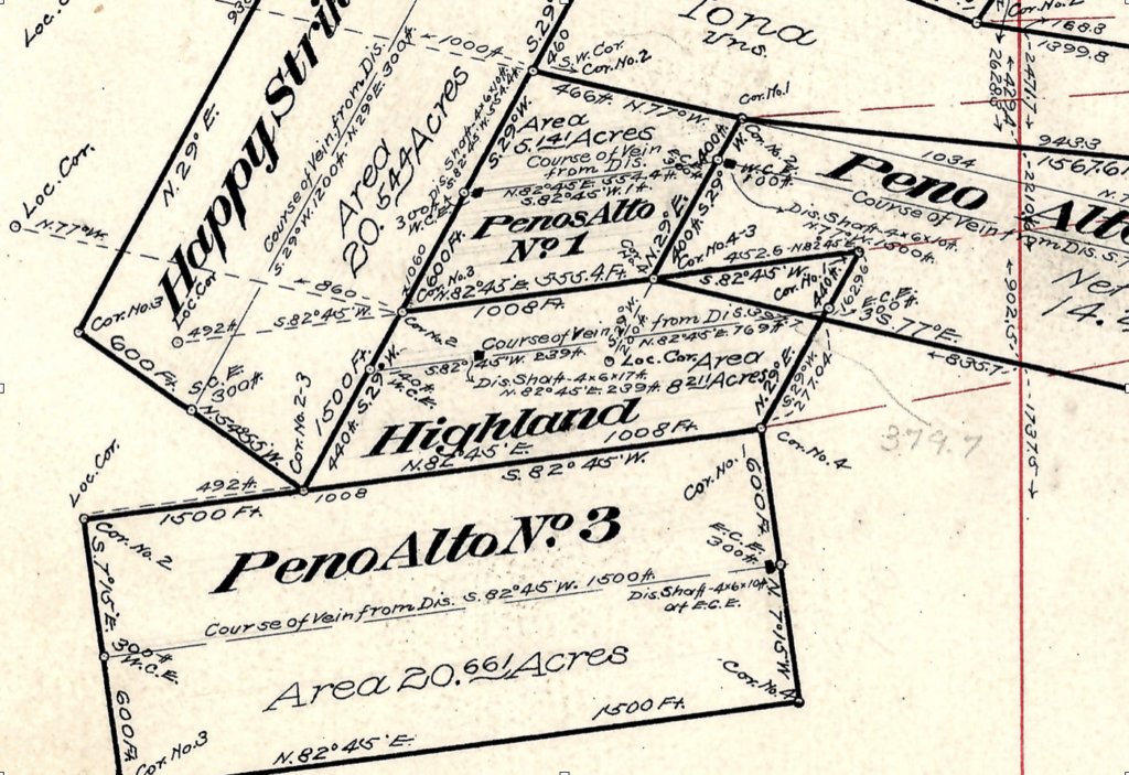
Peno Alto No. 2 x Penos Alto No. 1
Similarly, the Peno Alto No. 2 lode was located before the 1906 Penos Alto No. 1 clim, in...
Highland x Penos Alto No. 1 x Peno Alto No. 2
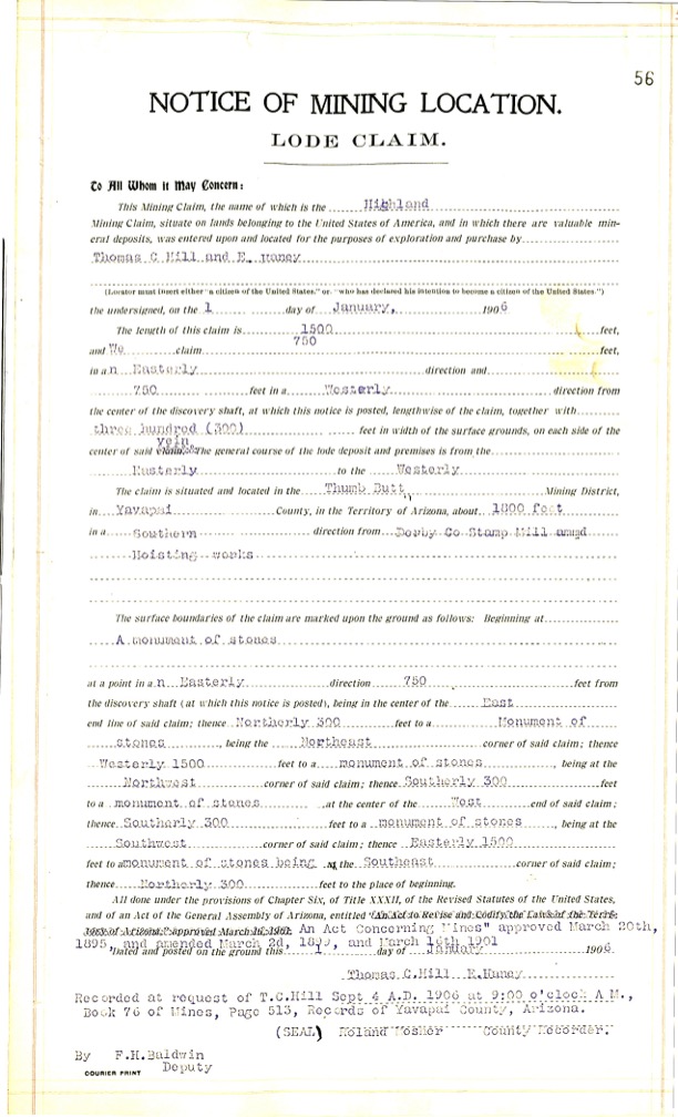
Highland Lode: The location notice of mining location for the Highland lode claim shows it was located by...
Penos Alto No. 1 x Highland x Happy Strike
Is the Penos Alto No. 1 valid if located in 1906, well after the Happy Strike, but purportedly...
Happy Strike x Puritan x Iona
The original Sept 9 1904 Notice of location for the Happy Strike lode provides a 1500’ x 600’...
IRON MASK x IRON MASK
Mineral Survey 2424 is comprised primarily of these amended notice of location records, that are still inconsistent with...
Puritan x Puritan 2
The original Notice of location for the Puritan No. 2 lode claim has the 1500’ distance running an...
Italian x Italian
Considering mineral survey 2424 far as any Italian lode claim is concerned…We are presented with the most recent...
Protection #2 x Puritan
The Protection #2 is platted at 950.8’ x 533.5’ by J.J. Fisher, however the lode location notice provides...
Knocker Doom x SunnySide x Great Eastern x SunnySide
The Knocker Doom Lode claim dated September 7, 1906, takes in 1500’ x 600’, 400’ east and 1100’...
Great Eastern x Surenough Lode Claims: Conflicted Locations
Point of Discovery The Great Eastern lode dated September 1, 1901, is depicted on M.S. 2424 at roughly...
IONA LODE CLAIM CONFLICTS: Puritan, Puritan No. 2, Happy Strike and Peno Alto No. 2
M.S. 2424 The Mineral Survey of record clearly does not accurately account for these pre-existing senior rights when...
The Graft Checklist
Information required when considering the purchase of mining properties: 1. Name of Property 2. Location 3. Acreage. 4....
Mining the Investor: Remarkable Stock Sale Offer
The Arizona Republican, Wednesday Morning, June 14, 1916 A Clear Statement of the Remarkable Stock Sale Offer of...
Madizelle Mining Company: Arizona Magazine
From ARIZONA magazine: “In this issue will be found the stock offering of the Madizelle Mining Company, designated...
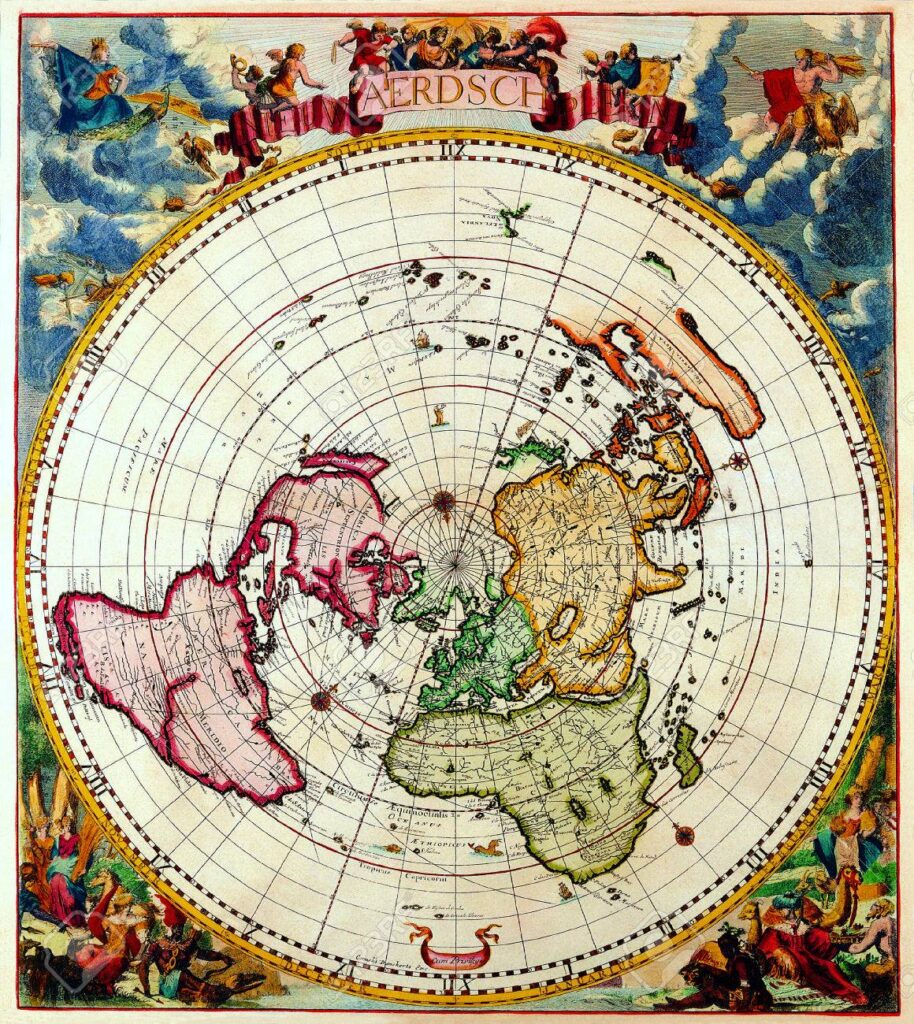
Pretty Looking ‘Maps’ of the General Land Office
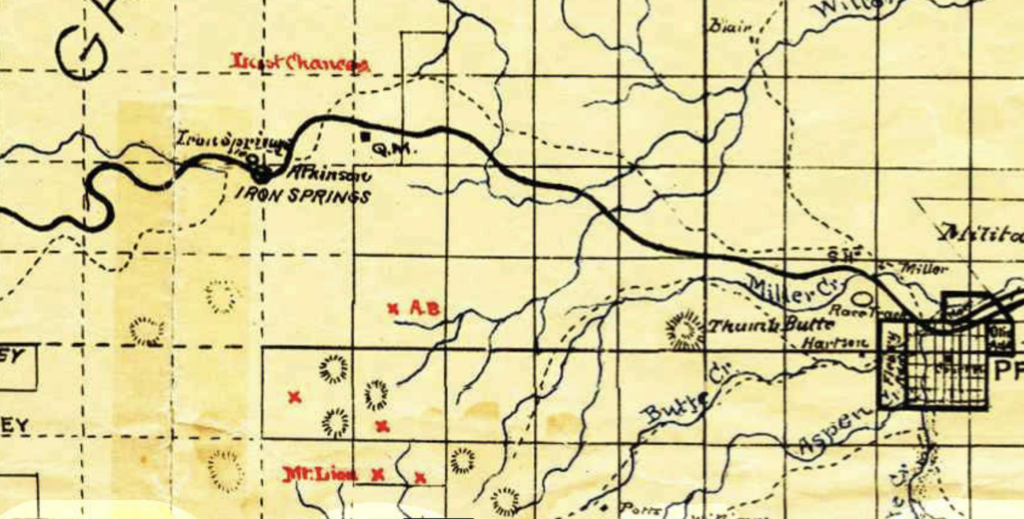
Derby Mines The drawing above is likely a preliminary version of what became U.S. Mineral Survey 2424. What...
Ace in the Hole: MS1397 A & B 1899, J.J Fisher
John ‘J/J/’ Fisher’s Last Chance Lode and Mill-site, Prescott Arizona, Yavapai County October 27 1899 Mineral Survey 1397,...
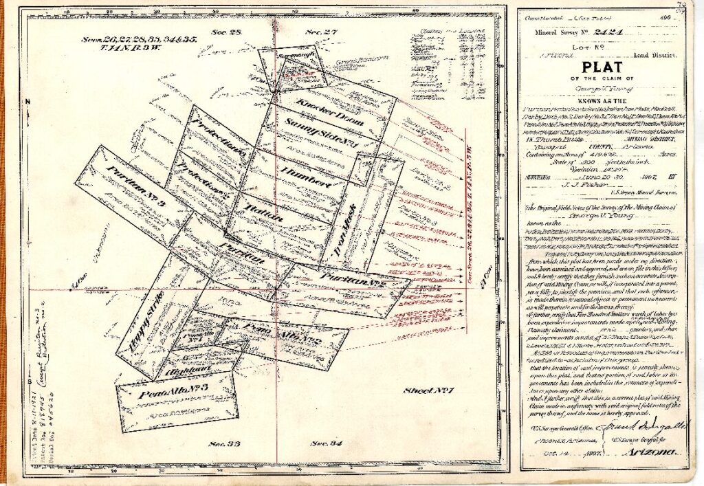
Mineral Survey 2424 MS2424 Prescott, Arizona Yavapai County; ‘Highland Pines’ >Enter the Unicorn<
The ‘PLAT’ shown above, Mineral Survey No. 2424, is fictitious. This is Sheet 1. See Sheet 2 below-...
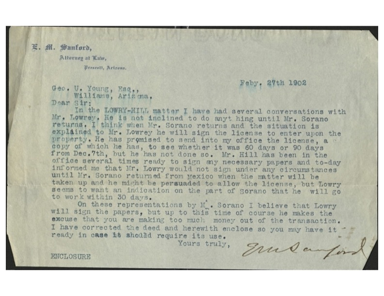
E.M. Sanford letters re: Highland Pines land leased to George U. Young, Mr. Hill, James R. Lowery, E.L. Sharpneck, George W. Sarano
Way before the concept for Highland Pines in the early 1950’s was ever a sparkle in the eyes...
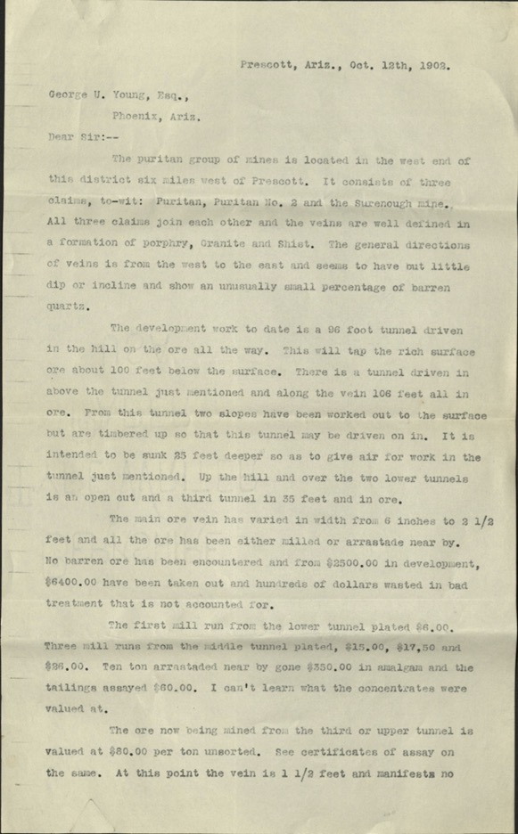
George U. Young ‘Puritan Group of Mines’ letter October 12th, 1902 Puritan, Puritan No. 2, Surenough lode claims
George W. Sarano was also the map maker of the 1903 Tributary Mining District of Prescott, and an...
Survey of Lode Claims for Patent: Royal A. Johnson, 1892
Important to Mine Owners Circular regarding Locations of Lode Claims, and the Survey of Same for Patent. Department...
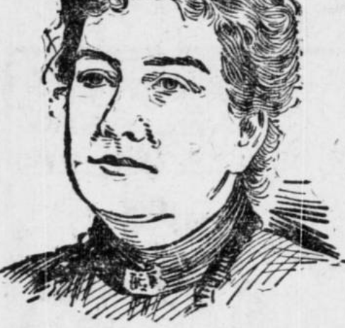
Romancing The Stone: M. Ellen Young
Mary Ellen Young was wife of George Ulysses Young. On April 11, 1907, about 90 days out from...
MINING SCAMS: Department Mines & Mineral Resources, ARIZONA
“A time honored method to bulk the public of millions of dollars is the ubiquitous mining swindle.” –...
Puffing & Bluffing: ‘Madizelle Group’ Sold in 1911?
There are seemingly endless examples of the twenty year long elaboration provided by George U. Young, such as...
Isabella Lode Claim: Thumb Butte Mining District
This mining claim, the name of which is the Isabella Mining Claim, situate on lands belonging to the...
Mineral Survey 2424 MS: Sheet 2 ‘The Derby Lodes’
Patented in 1921 via serialized United States Mineral Patent # 818945 to ‘Madizelle Mining Company’, was the mining...
Claim Jumping’ & Stock Chiselin’
The popular ‘camp’ off of the gully at issue. Claimed by many, but conquered only by Young.
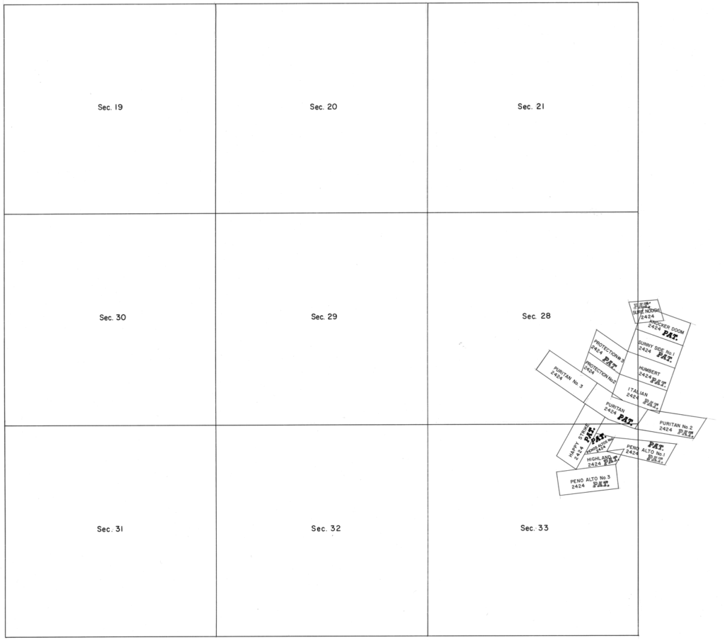
Assessor’s Record Maps: Highland Pines
The original Yavapai County Assessor’s ‘maps‘ relating to the various PLATS of record for ‘Highland Pines‘ are conflicting...
Field Notes: Mineral Surveys, Mining Claims
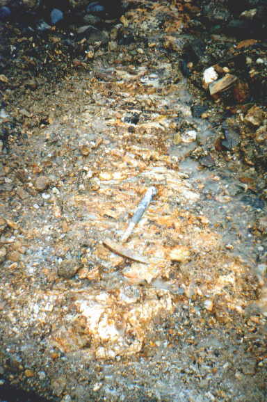
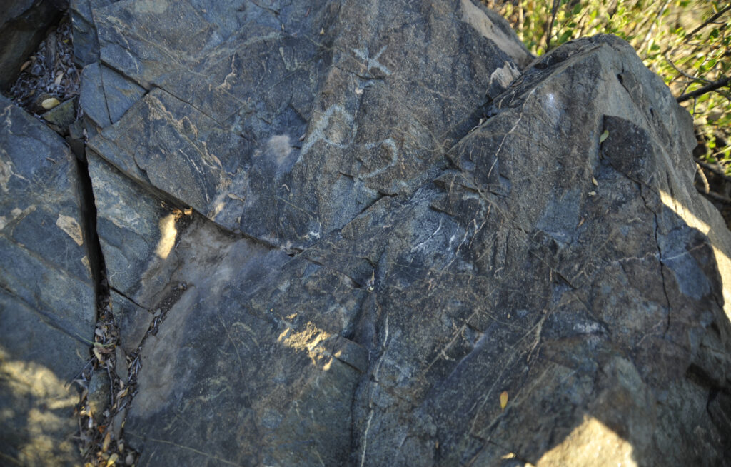
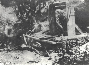
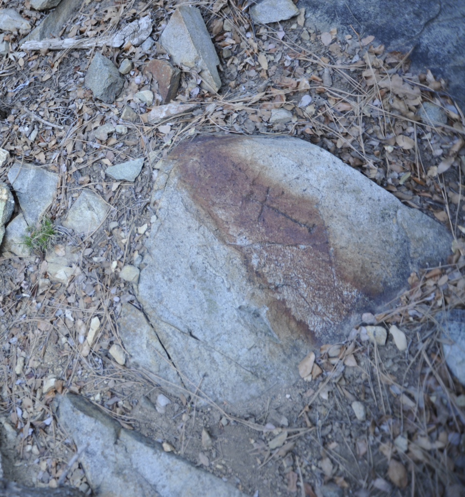
Below is photograph of a fictitious corner of a theoretical mining claim, that is way outside of it’s...
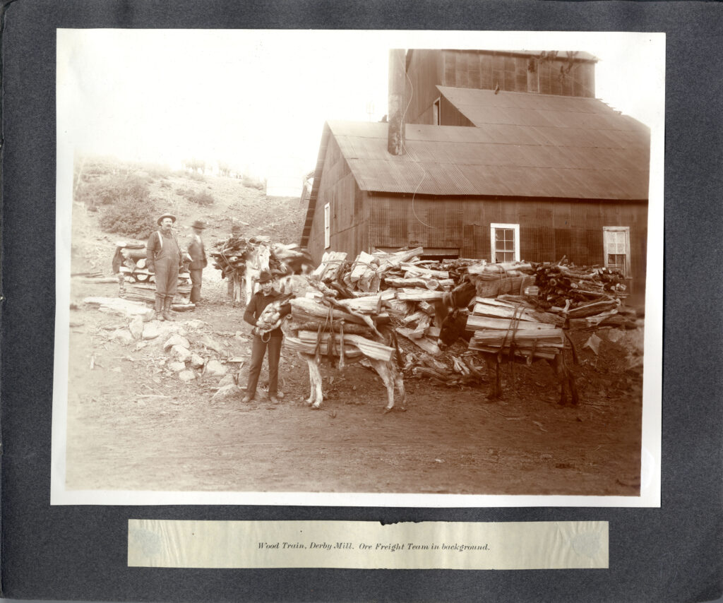
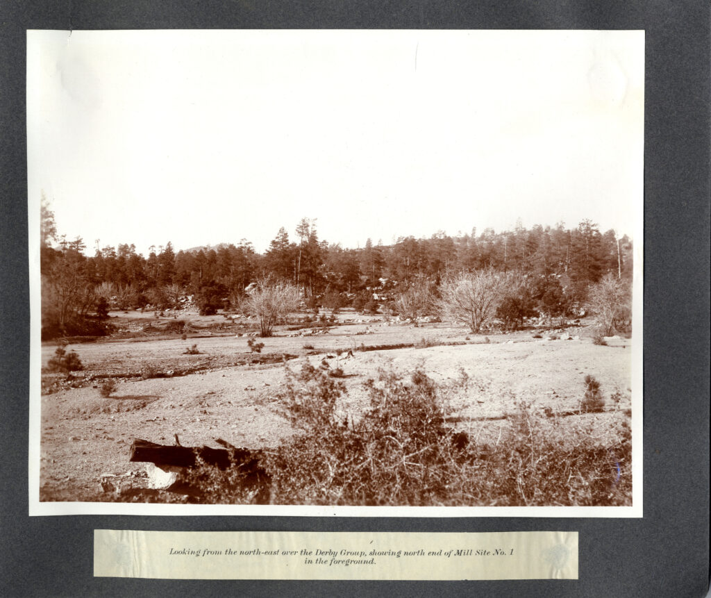
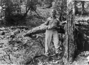
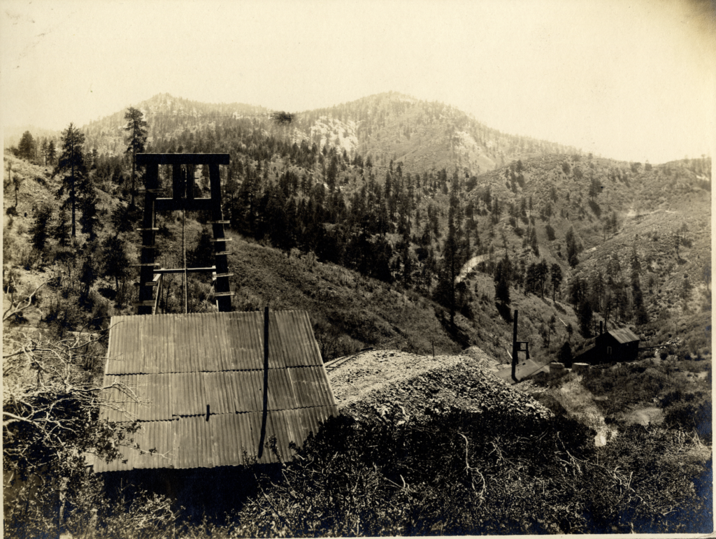
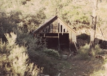
This is not the same ‘Mill’ site:
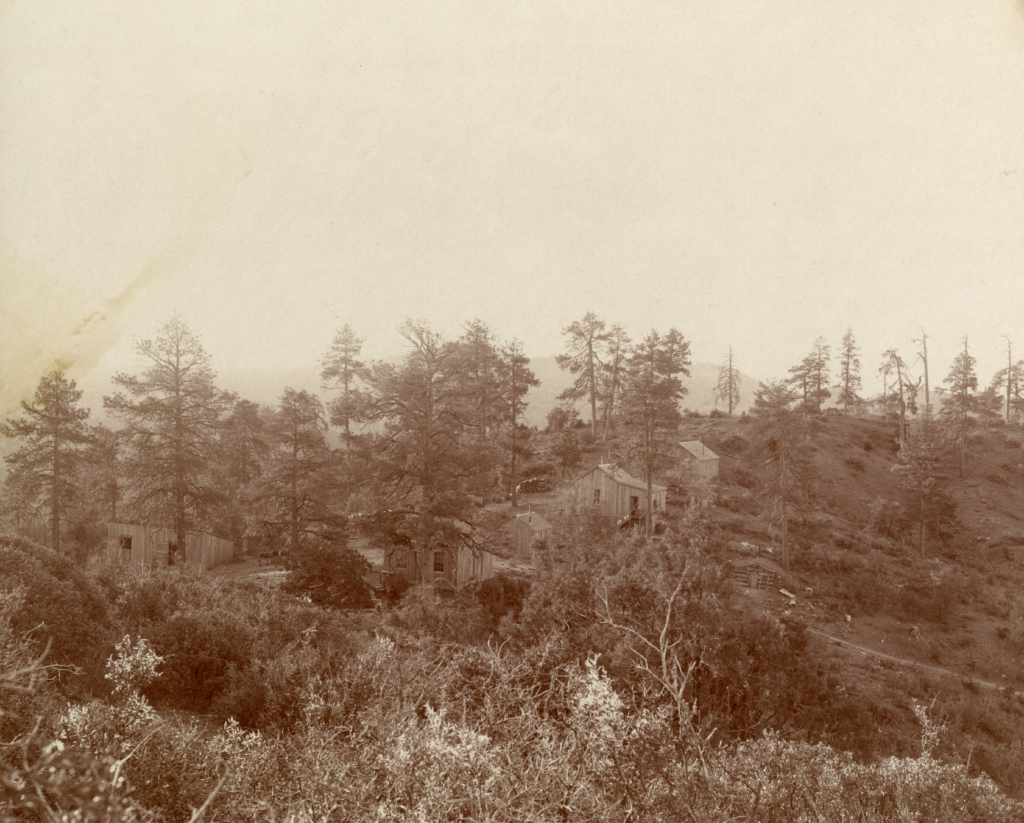
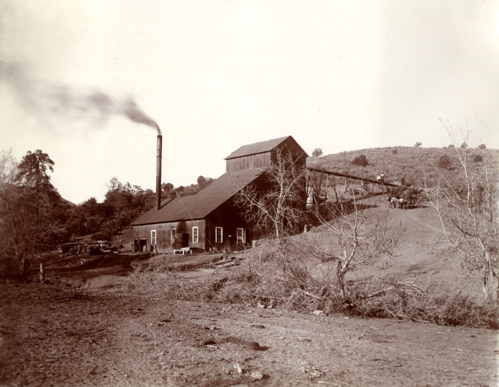
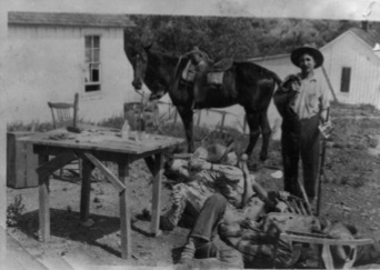
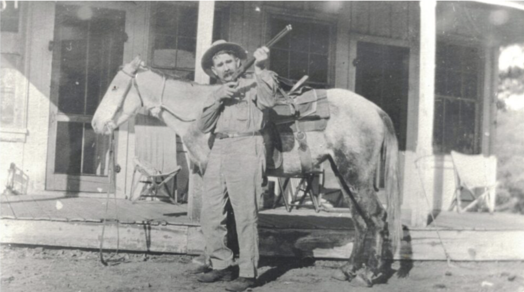
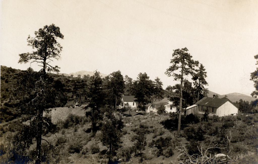
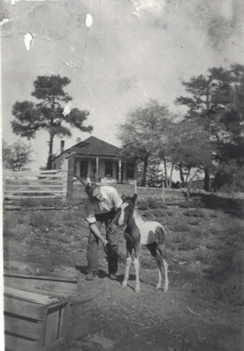
This is a photograph of George U. Young standing next to a Mill, presumably in the Thumb Butte...
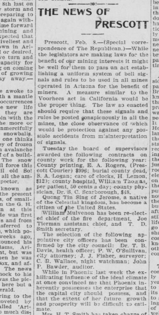
‘Yavapai County will be well represented in the edition as Mr. Young wields a facile pen.’
‘Geo. U. Young is back in town again. Mr. Young, in addition to his business as mining sale...
Dummy Locator: ‘..concealed interests, fraudulent locations, invalid in its entirety’
“If a locator has knowledge of a concealed interest and is a party to the use of dummy...
Prospectus: Madizelle Mining Company’s property, 1917
In the letter below from F.J. Kilner at the Empire State Building in Spokane Washington, dated May 14,...
Skirts Clean of any Scandal of Dishonest Promotion
The editor and publisher of Yavapai Magazine July 8th 1916 identifying the connection to the Madizelle Mining Company...
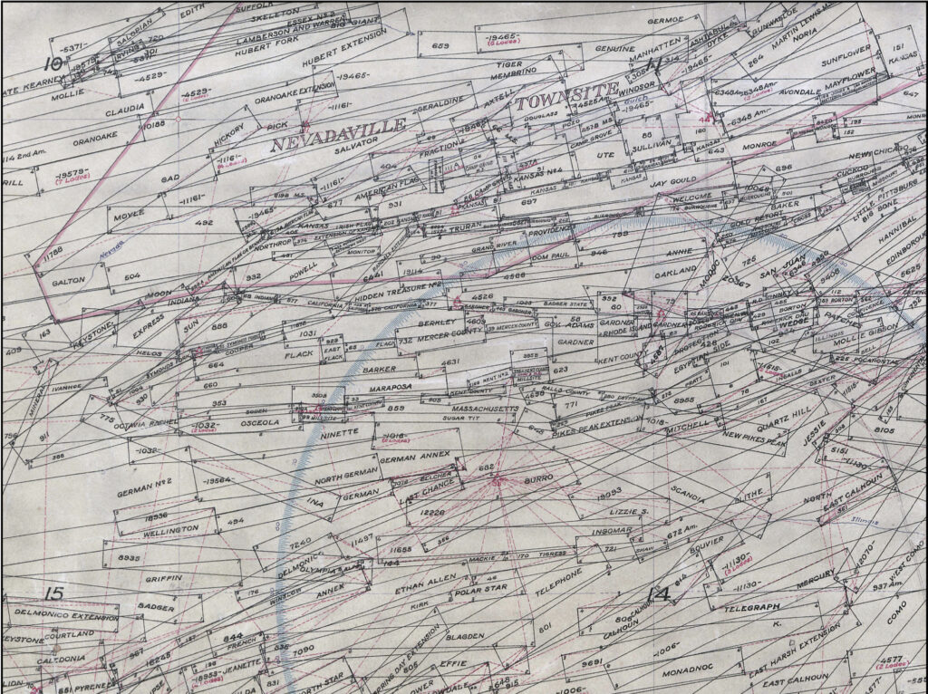
Arizona ‘Mineral Surveys’
A list of some very interesting records to pay special attention to, Mineral Surveys in Arizona from the...
Little Daisy- Jerome, J.J Fisher’s ‘Discovery’
The article below from the Arizona Weekly Journal Miner dated January 10th, 1900, just about sums it all...
Land Conscience: The ‘Missing’ Mineral Surveys of Arizona
Missing Mineral Surveys Notes & Plats (Bureau of Land Management February 1st 1986) Arizona
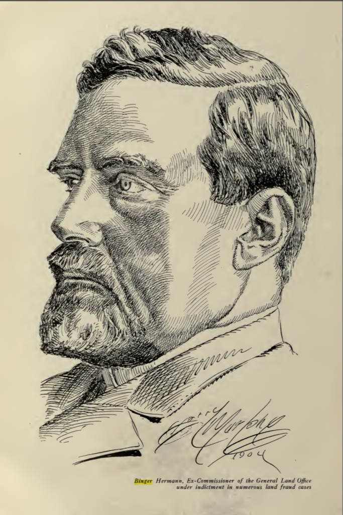
Excerpt from James Underhill’s book: ‘Mineral Land Surveying’ 1906 TRACTING-Binger Hermann Policies:
Record of Survey 2022: Highland Pine Properties “This is not an ALTA/NSPS Land Title Survey…”
2022-0025457 Unbelievable. The very first part on the face of this drawing of survey done in 2022 is...
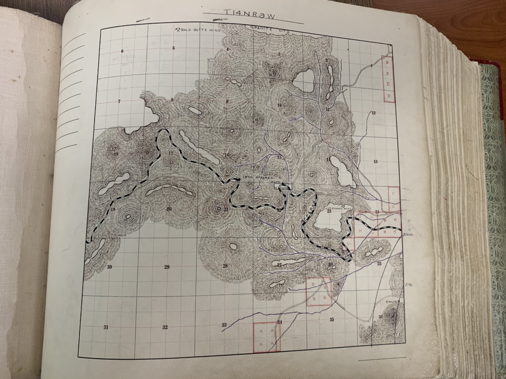
Mineral Survey MS2950 Yavapai County ‘GOLD STAR’ Lode Claim, Sections 31 & 36 T14N, R’s 3 &4W
What a fine specimen we have here! The Gold Star Lode claim Mineral Survey 2950 in Yavapai County...
Mineral Survey 2730: ‘Cancel Others’ Logan Copper Company, Yavapai County, J.J. Fisher, Frank Ingalls 1909
Yet another shining example of a Yavapai County Mineral Survey No. 2730. Here we have the PLAT of...
Geo U. Young/ Madizelle 1924: ‘tampering with the laws of nature’
Master Hand Letter from the office of George U. Young to Zane Grey dated December 19, 1924 on...
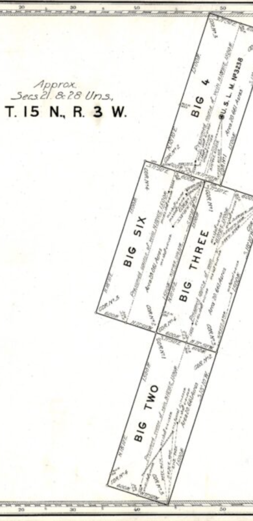
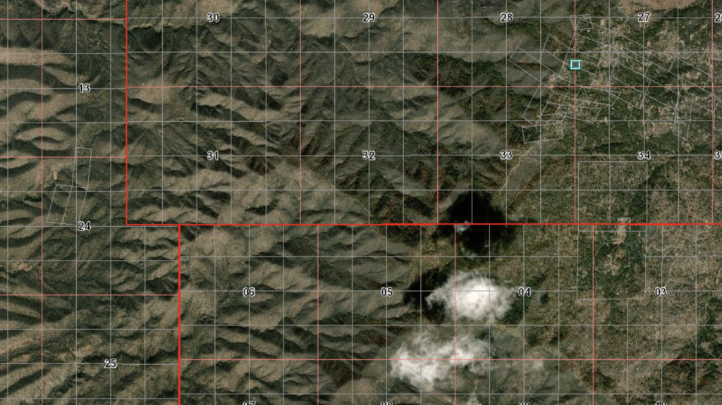
‘Presumed’ Course off Vein, ‘Approximate’ Sections 21 & 28 ‘Unsurveyed’ T15N R3W Merritt/ Frank Ingalls 1916 Yavapai
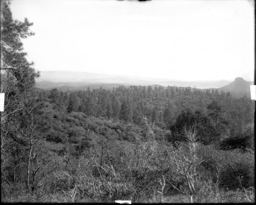
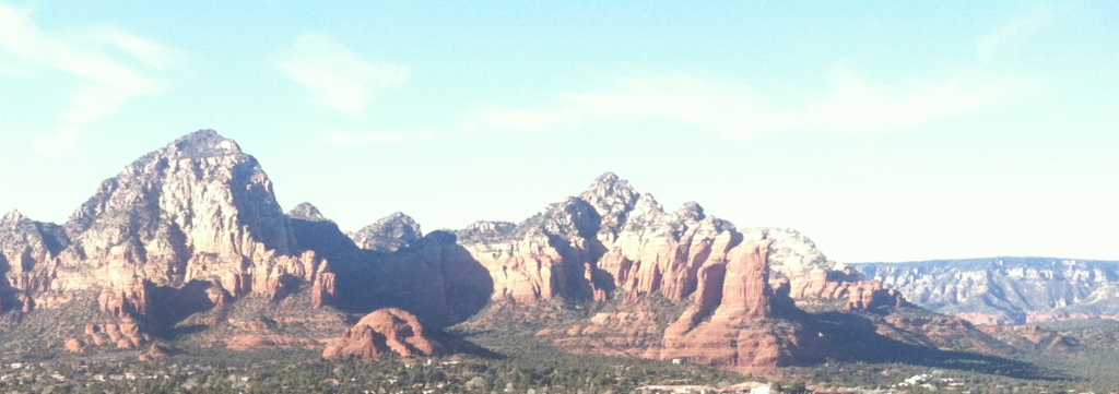
Where is this?
Blunders upon blunders of Fairy Dust
The first of many, Highland Pine Properties subdivision PLAT A from October 1955 Yavapai County Arizona, with indication...
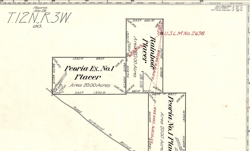
‘Relinquished’ MS2698 J.J. Fisher, Frank Ingalls Yavapai County 1909, Patent 07108
Mineral Survey MS2698 by J.J. Fisher -U.S.D.M.S. and approved by Frank Ingalls -Surveyor General for Arizona District, 1909....
MS1718 ‘Surprise’ J.J. Fisher Prescott, AZ Lode ‘Claims’ Section 11
From Corner No. 1 Surprise No. 2: S. 16 Degrees 06 W 6701.0 Ft. to Original Corner of...
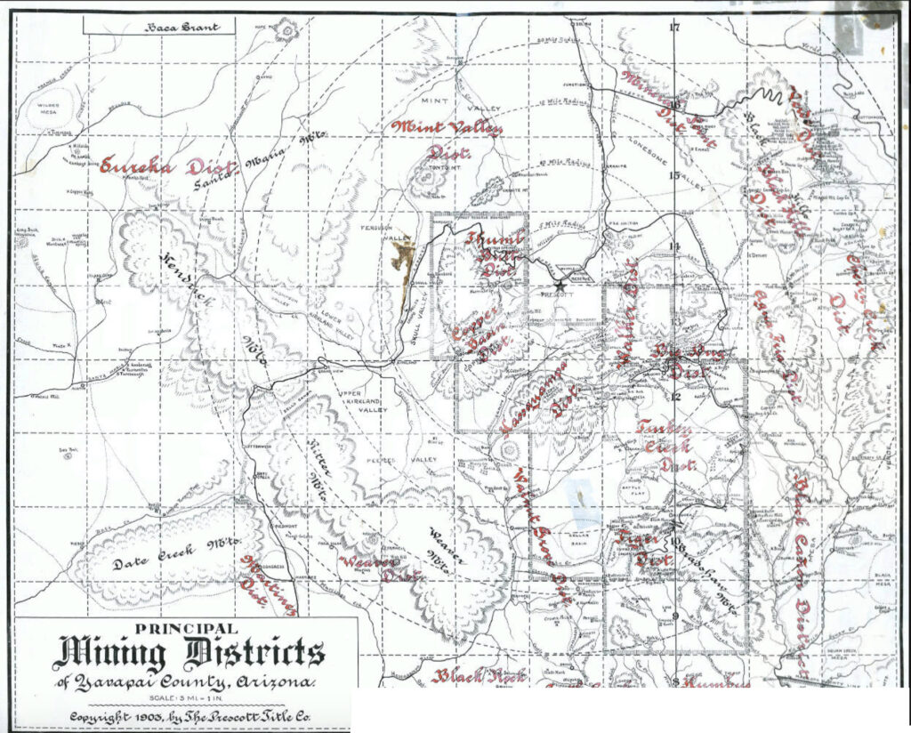
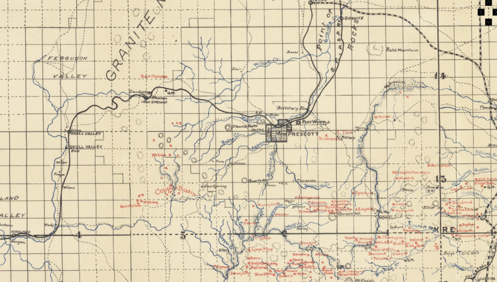
Yavapai County Arizona 1903
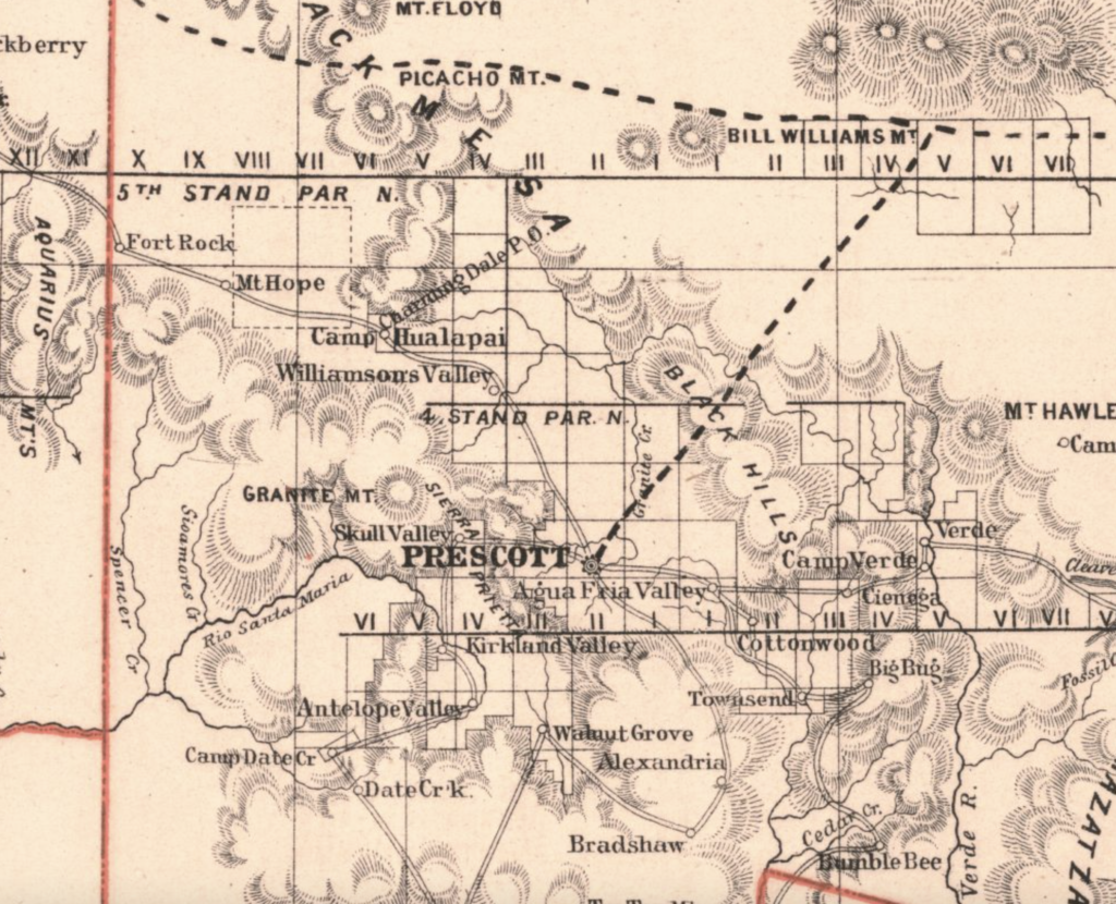
Ernest A Haggott, M.E. and Chas M. Richards, Eng. 1903 Map of Yavapai County Arizona
‘Original Surveys’ :…’eliminated incentives that encouraged fraud and corruption.’
From the U.S. Department of the Interior Bureau of Land Management module on ‘Original Surveys’: The Interior Department...
S.W. Foreman: Township 14 N Range 1,2,& 3 G.S.R.M. ‘Surveyed’ August 1-11 1871
Quite an amazing feat by U.S. surveyor S.W. Foreman to cover such a large area of land, all...
George U. Young’s Patenting of MS2424 Claims: Madizelle Mining Co./ George U. Young
” I went down to Hildreth’s office this morning in regard to the patent, and xxxx said he...
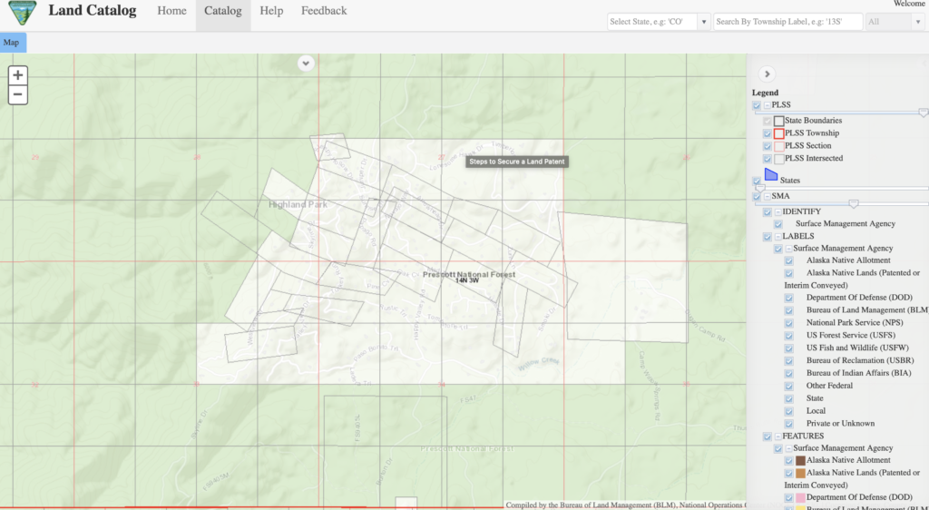
Highland Park, AZ Thumb Butte Mining District B.L.M. ‘Master Title Plats’
This is the filed original Master Title Plat of record with the Arizona Bureau of Land Management for...
Upper Working Shaft (Not Italian): On Windy Ridge Dr @ ‘Horse Corral’ near 1066 N. Skyline Drive
A nice rock pile and ‘upper working shaft’ beside the home at 1066 N. Skyline Drive in Prescott,...
Madizelle: Notice of Mining Location March 21, 1902
The claim is situated and located in the Thumb Butte Mining District In Yavapai County, In the Territory...
Township 14 North Range 4 West GSRM, S.W. Foreman, John Wasson -Surveyor General 1875
General Land Office plat of record for the Township 14 North Range 4 West in the Gila and...
Corner to Sections 28-27-33-34, S.W. Foreman 1871, Township 14North, Range 3 West
So the tale starts something like this: There once was a survey….in the area west of Prescott Arizona...
Cancelled: Mineral Survey MS1577, J.J. Fisher Yavapai County Black Hills Mining District 1902
Just one example of the plethora of problematic & administratively cancelled Mineral Survey Plat’s of this era. There...
George U. Young’s ‘Mammoth Mines’, Youngberg, Arizona, ‘Goldfield’: MS1130 & MS3886 -CANCELLED
Cancelled notations by the Arizona State director’s on the face of the original 1894 Plat of the Claim...
Pyriten: A ‘glib entrepreneur with unbounded optimism’
Arizona Mining Scams and Unassayable Ore Projects of the Late 20th Century by W. Scott Donaldson, dated December...
How to Correctly Interpret the Fictitious and Falsified Plat and Field Notes Returned By the U.S. Deputy Mineral Surveyors: Knocker Hermann
Aha…a clear and present ‘cloud on the monuments‘ themselves.
Fool me once….
Information required when considering the purchase of mining properties...or the purchase of ‘stock’ in fairy dust factories. This...
1871 Standard Lines, Township Exteriors ARIZONA S.W. Foreman, John Wasson -Surveyor General
A very interesting illustration of official record that identifies the Arizona territorial plat of standard lines and township...

George W. Sarano, Swindler: Ideal Mining Company, Prescott AZ
Now why would anyone bring a bar of Gold into the town of Prescott worth $400 in 1901?...
Highland Pines Plat “E” a Portion of Mineral ‘Survey’ NO. 2424: yeah…but not really.
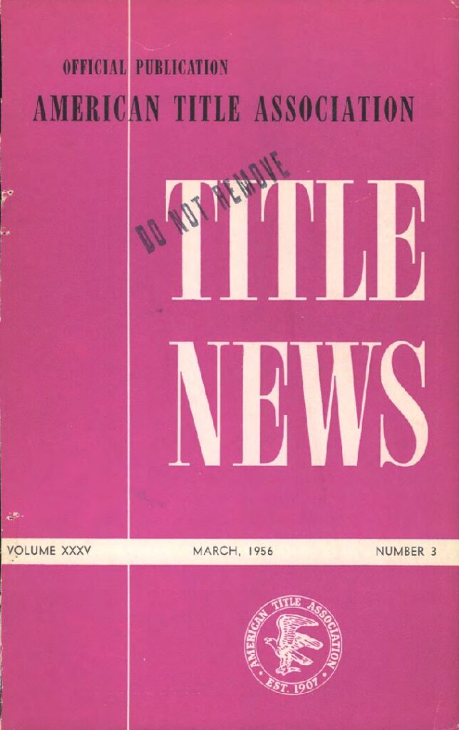
American Title Association Est. 1907, Volume XXXV Number 3, March 1956
Norman Hale: ‘IONA’ Notice of Mining Location/ Lode Claim
The Iona lode claim (Statutes of Iona) Notice of Mining Location, entered upon and located for the purpose...
Binger Hermann Policy Problems: Corrections, D.O.I. Decisions
And a third situation is where there appears to be a conflict, but there is no conflict, the...
Townships 14 North Range 3 West, 13 North Range 3 West, Original Survey Plat 1871
Yavapai County Arizona Original Plat Map Survey 1871, Township 13 North Range 3 West
Executive Order: Revocation, Withdrawing Public Lands in T14N, R3W G.S.R.B.M., Franklin D. Roosevelt January 25, 1936
Highland Pines Prescott Arizona in Township 14N, Range 3 West Yavapai County
Lowry-Hill 1896 Notice of Mining Location Quartz (Lode) Claim
Original Notice of Mining Claim Location circa 1896, Yavapai Sheriff James R. Lowry (Lowery) and Thomas C. Hill....
Protection – Notice of Mining Location – Lode Claim, Highland Pines – Prescott, Arizona
‘Protection’ Lode Claim of George U. Young existed of record prior to the Protection #2 and the Protection...
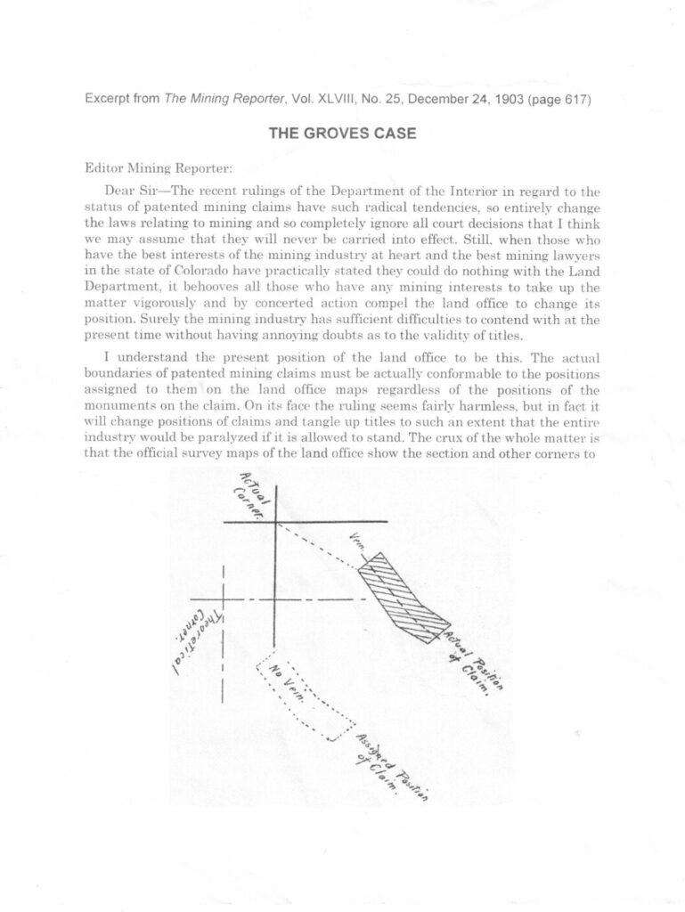
The Mining Reporter 1903; The Groves Case, Theoretical Corners, Positions, Mining Claims
Actual Corners v. Theoretical Corners
Madizelle Mining Company, 1908 Articles of Incorporation; ‘Philadelphia’
What happened to the Derby Mine? The name of the corporation is (now) Madizelle Mining Company. A serialized...
John Wasson, Surveyor General Land Office G.L.O. 1871, Arizona Territory: T14N Range 3 West G.S.R.B.M.:
John Wasson, U.S. Surveyor General Arizona Territory 1871 The original Township 14 North Range 3 West Government Land...
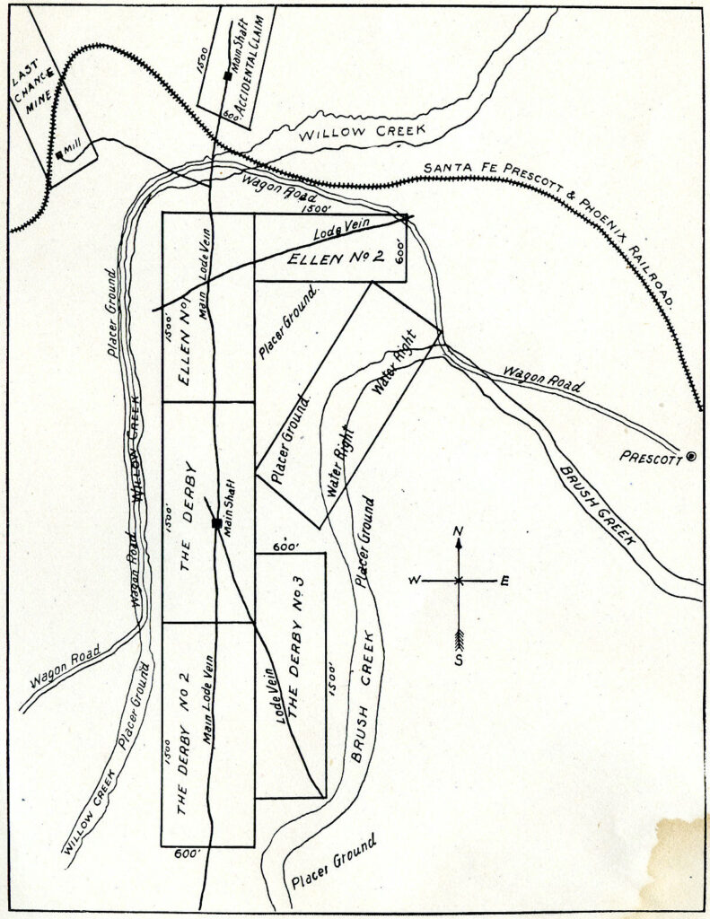
Prospectus Map : Derby, Ellen, Last Chance, Accidental Lode Mining Claims
North, South, East, West positions of the Derby Mine, Ellen Mine, Accidental Mine, Last Chance Lode Claims Prescott,...
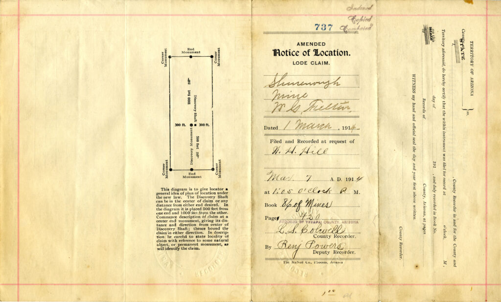
Shurenough Lode Claim: March 1, 1914
Shurenough Lode Claim, Situated and Located ‘About a half mile in a westerly direction from office and mill...
Add Title
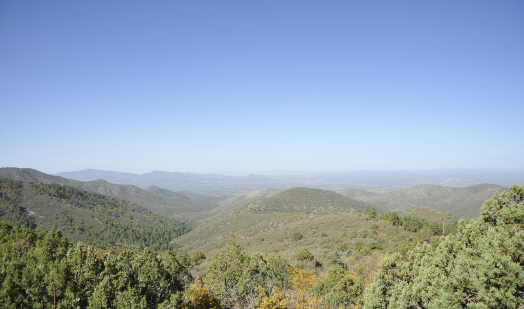
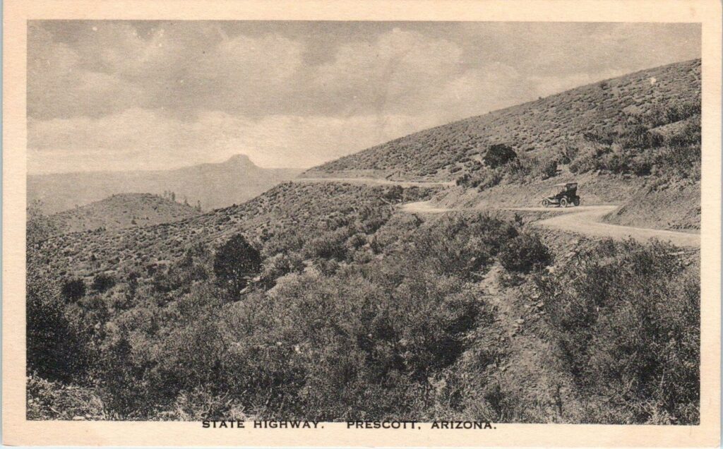
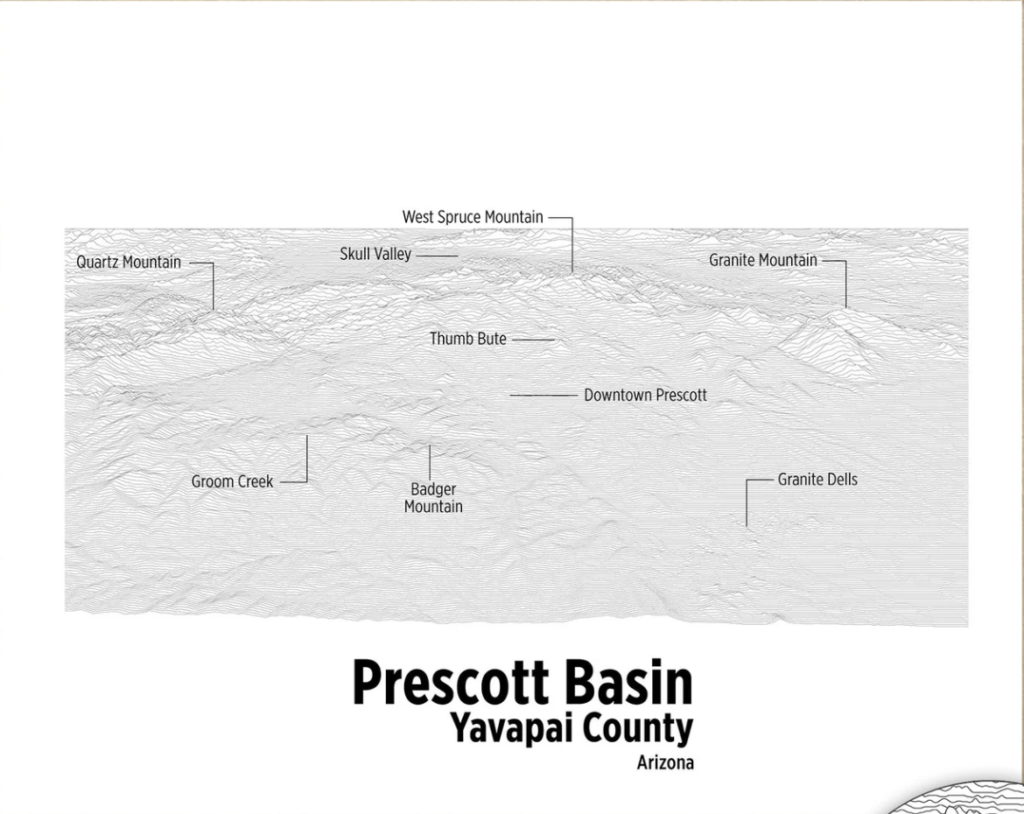
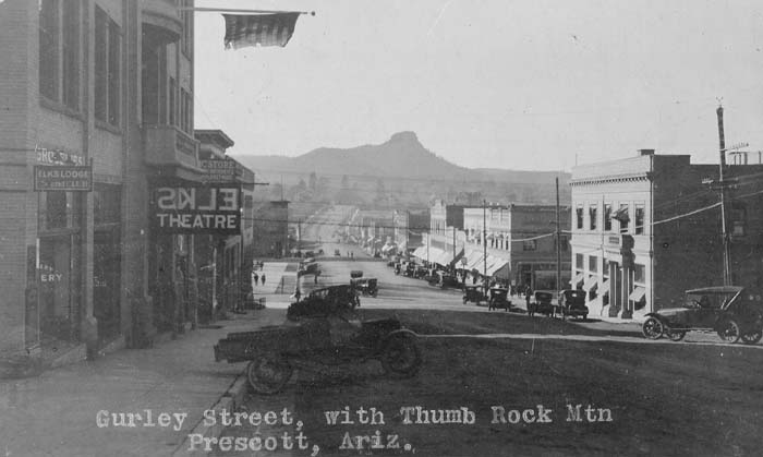
That is the ‘title’ to this post. Prescott National Forest That’s it! That is the answer, the Prescott...
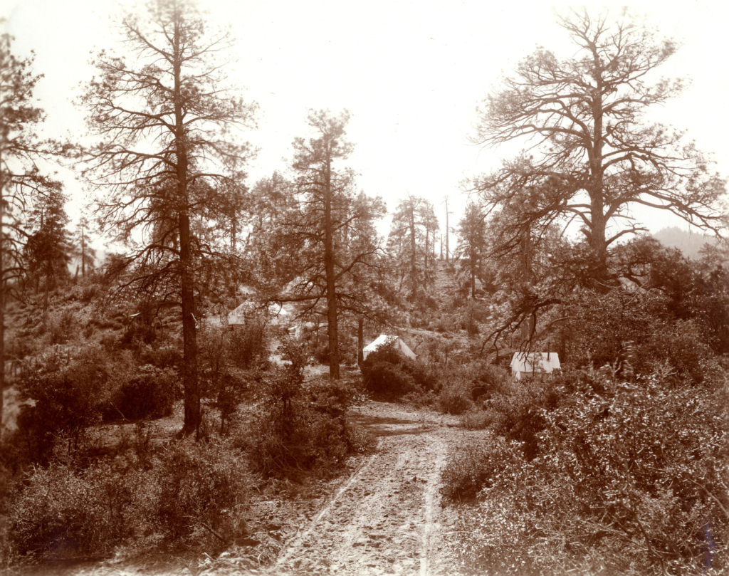
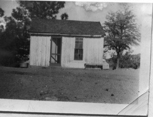
T.C. Hill Camp, Ideal Camp, Lowry Camp, Derby Camp or Madizelle Mining Camp? Take your pick…
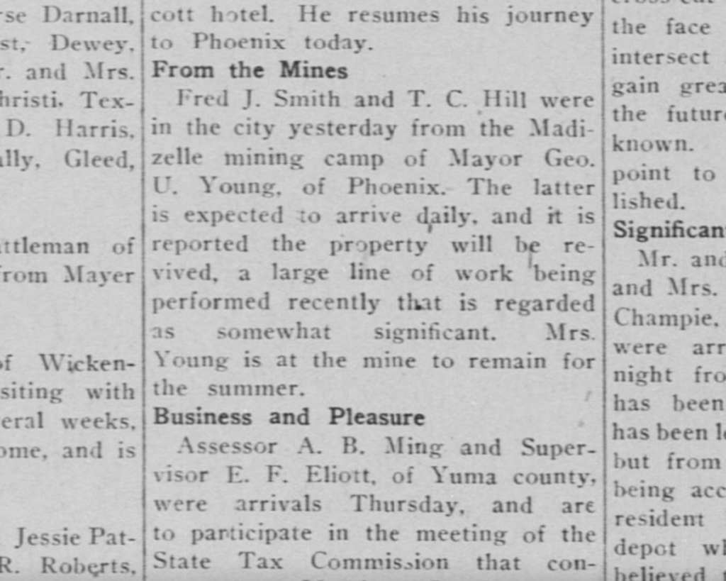
From the Camp: Fred J. Smith did not exist at the property until late in 1911, when he...
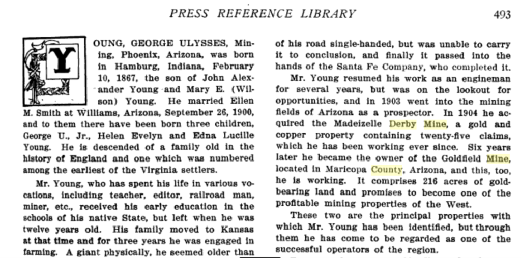
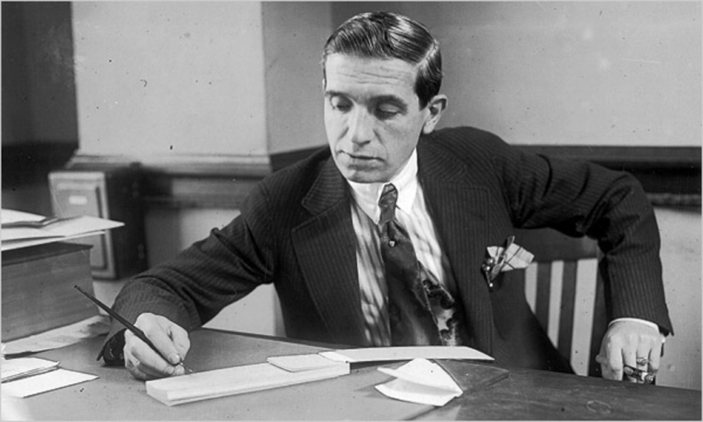
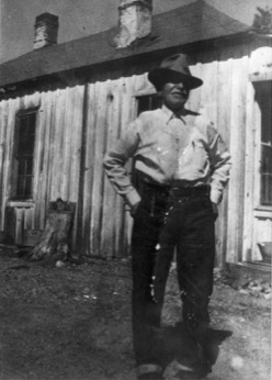
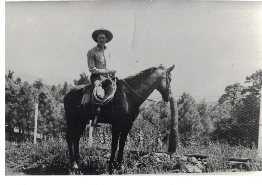
George Ulysses Young, Prospector
This is an inaccurate accounting of George U. Young’s mining affairs, the timeline and his role in the...
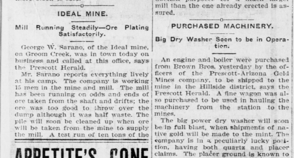
George W. Sarano and the ‘Ideal’ connection
Mr. George W. Sarano was a busy man in Prescott’s mining era. He was purportedly a Mining District...
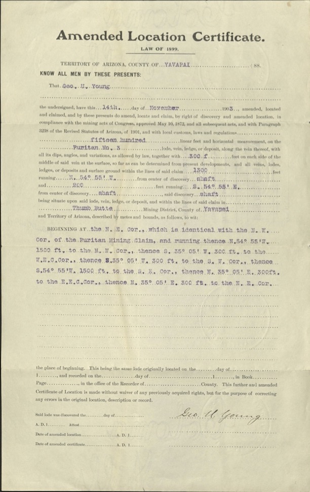
Puritan NO. 3 Amended Location Certificate, Law of 1899, George U. Young 1903
The only certificate of record for the referenced Puritan No. 3 lode claim of U.S. Mineral Survey 2424,...
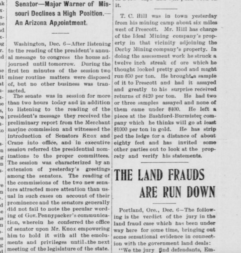
The Ideal Mining Company’s Property: ‘about six miles west of Prescott’
The Land Frauds are Run Down… “T.C. Hill was in town yesterday from his mining camp about six...
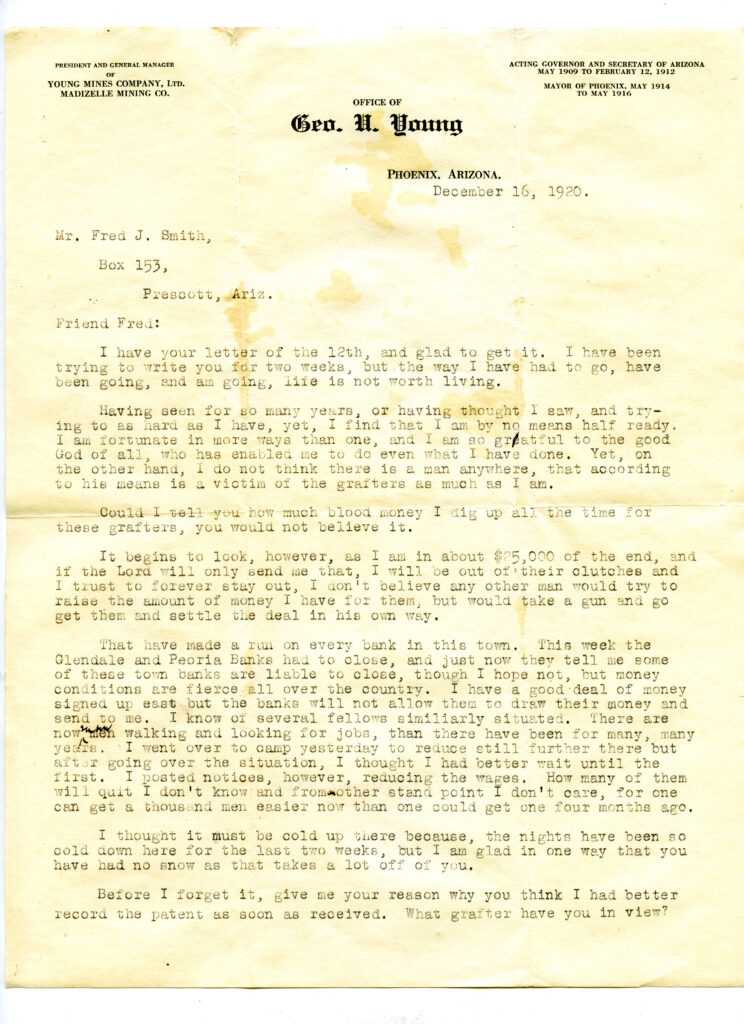
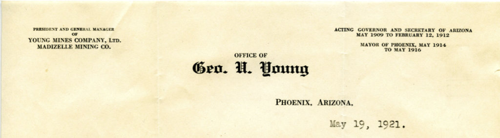
Office of George U. Young: President and General Manager Young Mines Company Ltd., Madizelle Mining Co.
Letter of December 16, 1920, to caretaker of the land Fred J. Smith at Prescott, during the land...
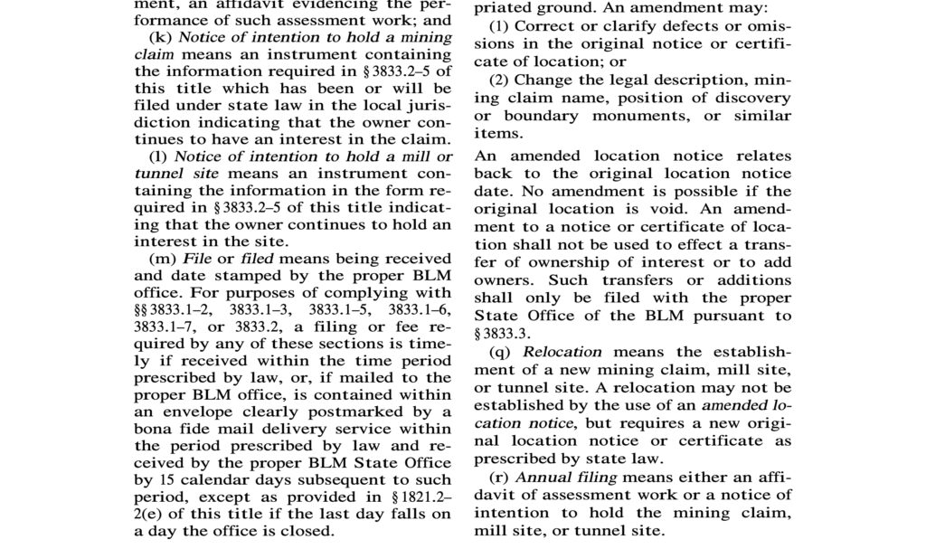
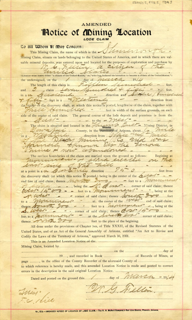
AMENDED LOCATION NOTICES: (q) RELOCATION
“An amended location notice relates back to the original location notice date. No amendment is possible if the...
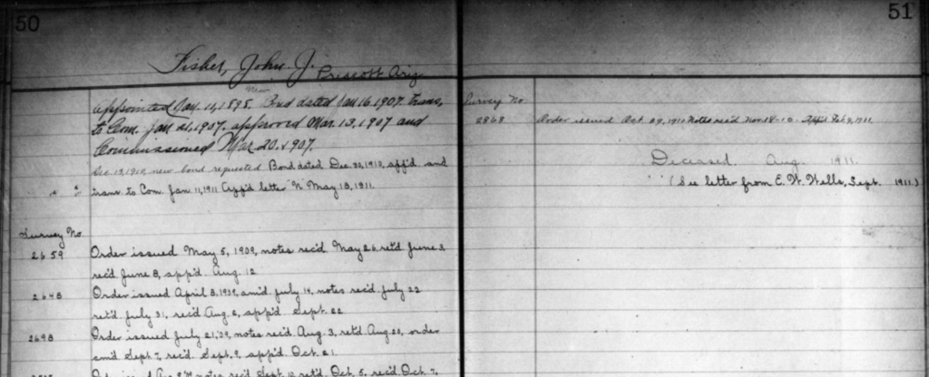
John J. Fisher: United States Deputy Mineral Surveyor, Prescott, Arizona
Appointment of John ‘J.J.’ Fisher, United States Deputy Mineral Surveyor Prescott Arizona. J.J. Fisher is one of the...
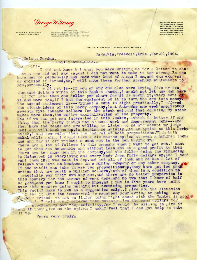
George U. Young: Mines & Mining Stock Bought and Sold, 1904 Letter
Mining the Investor letter dated November 21, 1904, from George U. Young via ‘Camp’ at Derby Mine stock,...
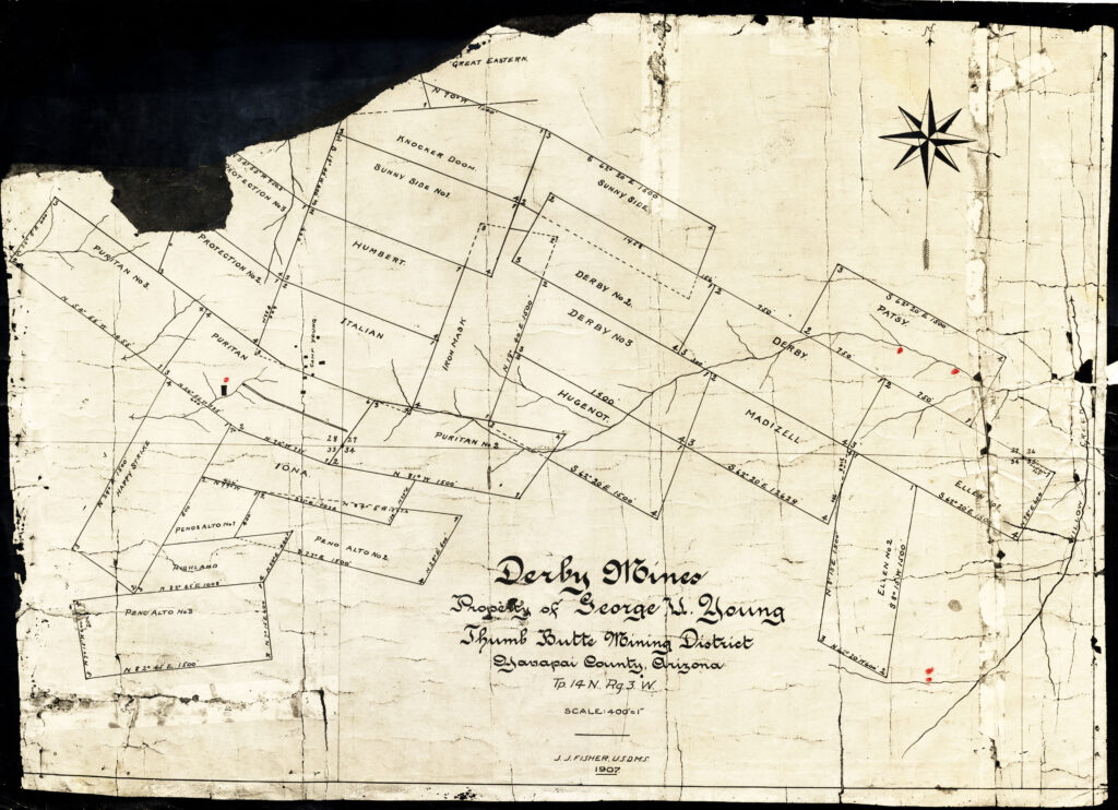
MS2424 Preliminary drawing 1907 J.J. Fisher: Property of George U. Young Thumb Butte District
Derby Mines? So this is not a survey, but just a drawing of an idea for the future...
The Mining Reporter: 1903 the ‘Groves Case’
Assigned position, vs. actual (legal/monumented) positions on the ground. Vein vs. NO VEIN, tangling up titles.